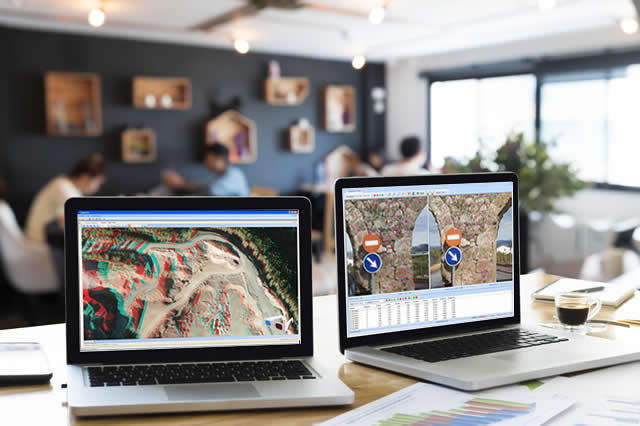
With our technology, the maximum use is obtained of the geomatic products generated from drone flights and photogrammetry applications.
Our first research project related to this matter had as its main result the launch of our TcpStereo application for stereoscopic vector restitution synchronized with CAD.
Later we worked on an R & D project consisting of creation of a series of computer applications that aimed to reduce the time of manual editing to create three-dimensional models, by combining the technologies of processing points with laser scanner and terrestrial photogrammetry.
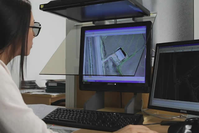
Further research in collaboration with various universities allowed us to create a prototype of a photogrammetric application to automatically obtain both point clouds, digital surface models and orthophotos from images acquired in photogrammetric flights with conventional cameras embarked on unmanned aerial vehicles.

Exploitation of geomatic products
Our Tcp PointCloud Editor application is the ideal complement to get the most out of the results generated by photogrammetry applications, offering among others the following functions:
- Import and export of the most common formats in the market
- Viewing, editing, and filtering point clouds
- Profiles and volumes from digital elevation models
- Visualization of orthophotos in 3D

Request for Collaboration
APLITOP, as a technology-based company, meets the ideal conditions to participate in calls for R & D projects in collaboration with other companies: highly specialized human team, extensive distribution network, international project experience , location in Malaga, etc.
If you want us to study the possibility of participating in a project as a partner or subcontractor, and is related to the development of applications in the Surveying or Engineering sectors Civil, we will be happy to study your case.
Projects
TcpStorm
Mid-range scanning is a system increasingly used in public works as a substitute for complex surveying studies. This system provides multiple advantages, as it provides more data volume, more accurately and in less time. The software used presents the problem that the visualization of large clouds of points can pose performance problems, they do not offer advanced filtering methods and none of them solve the problem of generating a coherent and error-free mesh of triangles.
View details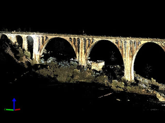
Related products
tcp PointCloud Editor

AI-powered point cloud software for surveying, engineering, architecture and design
European Regional Development Fund.
APLITOP S.L. has been a beneficiary of the European Regional Development Fund whose objective is to improve the use and quality of information and communication technologies and access to them and thanks to which it has optimized our commercial processes for the improvement of competitiveness and productivity of the company 2022. For this, it has had the support of the INNOCAMARA PROGRAM of the Chamber of Commerce of Malaga. "A way of making Europe".
Funded by the European Union NextGenerationEU.
APLITOP S.L. has benefited from the INTERNATIONAL MENTORING Programme to improve and consolidate its international positioning through the implementation of an International Action Plan. The programme is financed by European Next Generation-EU funds, as part of the Recovery, Transformation and Resilience Plan.
Compromiso con el Medio Ambiente
Midiendo el futuro con sostenibilidad. Implementamos medidas responsables para reducir las emisiones de CO₂ el desarrollo de nuestras soluciones