Use scanner point clouds, LiDAR or photogrammetry, as well as orthophotos, digital elevation models and aerial imagery in your projects.
Tecnology
Today, massive data capture methods are commonly used to quickly obtain the digital twin of the work, using terrestrial scanners, LiDAR sensors and photogrammetric applications that process images taken by drones.
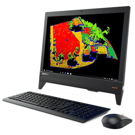
APLITOP has extensive experience in the exploitation of point clouds for surveying projects. Our Tcp PointCloud Editor software allows you to view and edit imported points of the most common formats in the market, as well as generate digital elevation models, obtain profiles, perform measurements and produce or publish high quality results.
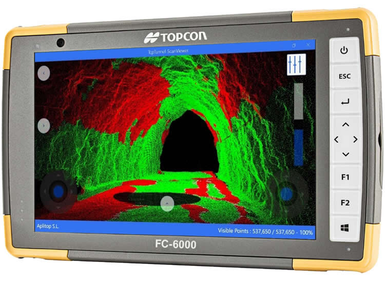
For tunnel projects, with TcpTunnel Scan you can scan and analyze the current status in real time on the construction site itself. In the office, TcpScancyr calculates profiles from the point cloud, and allows the visualization of areas of infra and over-excavation, generation of reports, inspection maps, route simulation, etc.
Research & Development
In APLITOP we are aware that point clouds have an increasing importance, being necessary new tools that allow filtering and interpreting automatically large amounts of data.
For this reason, we have participated in various research projects, which have allowed us to develop our own technology for the management of point clouds, and we continue working to offer the latest advances to our users, through the application of Artificial Intelligence with Machine Learning and other advanced techniques.
Request for Collaboration
APLITOP, as a technology-based company, meets the ideal conditions to participate in calls for R & D projects in collaboration with other companies: highly specialized human team, extensive distribution network, international project experience , location in Malaga, etc.
If you want us to study the possibility of participating in a project as a partner or subcontractor, and is related to the development of applications in the Surveying or Engineering sectors Civil, we will be happy to study your case.
Projects
Pandora
The PANDORA project has developed new technological solutions to facilitate the implementation of multiple applications in the life cycle of different use cases in infrastructure projects, which will improve both the acquiringand the exploitation ofinformation, representation and interpretation.
A solution based on LiDAR technology and high-resolution vision has been developed from 360º cameras that lets youobtain high added value information in environments without GNSS signal (tunnels, etc.), integrated into a platform that can be integrated into unmanned aerial vehicles (UAVs) and ground vehicles (UGV, off-road vehicles, etc.).
View details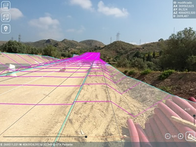
Related products
tcp PointCloud Editor

AI-powered point cloud software for surveying, engineering, architecture and design
European Regional Development Fund.
APLITOP S.L. has been a beneficiary of the European Regional Development Fund whose objective is to improve the use and quality of information and communication technologies and access to them and thanks to which it has optimized our commercial processes for the improvement of competitiveness and productivity of the company 2022. For this, it has had the support of the INNOCAMARA PROGRAM of the Chamber of Commerce of Malaga. "A way of making Europe".
Funded by the European Union NextGenerationEU.
APLITOP S.L. has benefited from the INTERNATIONAL MENTORING Programme to improve and consolidate its international positioning through the implementation of an International Action Plan. The programme is financed by European Next Generation-EU funds, as part of the Recovery, Transformation and Resilience Plan.
Compromiso con el Medio Ambiente
Midiendo el futuro con sostenibilidad. Implementamos medidas responsables para reducir las emisiones de CO₂ el desarrollo de nuestras soluciones