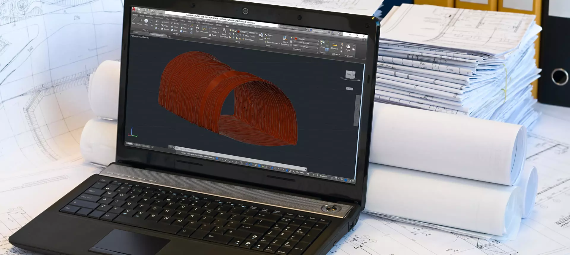

About the product
- Processing of data captured by total stations equipped with
tcpTUNNEL - Installs as an add-on for CAD
- Definition of sections by selecting polylines
- Profile calculation and editing
- Customizable drawing
- Report of under- and over-excavation areas and volumes
- Generation of 3D models and export to IFC
tcpTUNNEL CAD screenshots
Explore screenshots and examples of the product in action
Solutions by sector
See how tcpTUNNEL CAD adapts to the needs of your professional sector.
BIM
Our software makes it easy to exchange surveying and civil project data through industry OpenBIM standards such as IFC and BCF.
Frequently Asked Questions
Answers to common questions about tcpTUNNEL CAD
tcpTUNNEL CAD is an application that installs as an add-on for AutoCAD®, BricsCAD® or ZWCAD® to process tunnel data captured with a total station. It lets you define projects, calculate profiles, compare sections, edit measured data, generate excavation reports and create technical documentation in a CAD environment.
tcpTUNNEL is geared toward field work with a total station, profile capture and stake-out. tcpTUNNEL CAD is used in the office to process that data, draw profiles, calculate deviations, generate reports, analyze volumes and prepare the tunnel's technical reports.
tcpTUNNEL CAD processes data captured with total stations equipped with tcpTUNNEL or other solutions. It lets you work with axes, elevations, sections, point files and common formats in tunnel projects, such as LandXML or Trimble TXL.
In tcpTUNNEL CAD, each project is defined through a plan axis, elevation, sections and point files. Sections can be created numerically or by selecting a polyline in CAD, applied along the axis and have their dimensions interpolated.
Yes. tcpTUNNEL CAD lets you calculate, represent and edit measured profiles from points captured in the field. It includes tools to clean, add or move points before drawing, as well as label deviations, chainages, elevations, areas and other technical values.
Yes. tcpTUNNEL CAD compares the theoretical sections with the measured sections to calculate under- and over-excavation areas and volumes. It also generates technical reports for printing, Excel and other formats used in site control and documentation.
Yes. tcpTUNNEL CAD lets you generate 3D models of the tunnel, create wireframe views or realistic models and move along the axis. It can also export information in technical formats such as IFC, making integration with BIM workflows and digital documentation easier.
Ready to try tcpTUNNEL CAD?
Download the free trial version or request a custom quote for your company.