In addition to terrain modeling tools, our software simplifies plot subdivision, road design for urbanizations, BIM integration, and more.
Building and Urbanization
- Topographic surveys
- Integration of point clouds, cartography, orthophotos, and CAD, GIS, BIM data
- Plot subdivisions
- 3D Digital terrain models
- Contour lines and profiles
- Analysis of slopes, orientations, and visibility
- Design of gradings and earthworks
- Design of urbanization roads
- Design of utility networks (sewerage, water supply, electricity, gas, etc.)
- Determination of the precise location of the elements of the work
- Control and monitoring of the project
- Verification of the conformity of the work with the drawings and specifications
- Generation of reports and drawings
- Presentation of 3D models and visualizations of the project
- Analysis of the environmental impact of the work
Blueprint
Terrain Modeling and Analysis
Design of Infrastructure and Services
Control and Supervision of the Work
Project Documentation and Presentation
We can help you
Need help? Click on the following button to contact us and we will be happy to assist you.
Related products
tcpMDT Standard
Software for surveying, terrain modeling, contours, profiles and volumes.
tcpMDT Professional
Software for surveying, civil engineering, architecture and construction projects
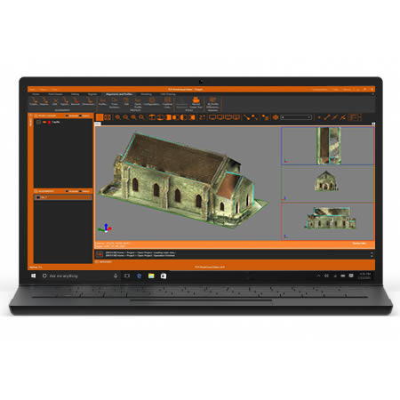
tcp PointCloud Editor

AI-powered point cloud software for surveying, engineering, architecture and design
Success Stories
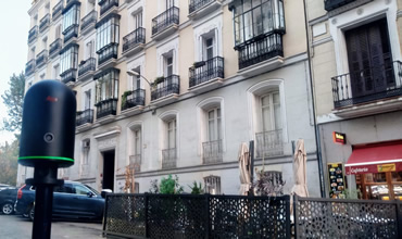
3D Scanning Works of Point Clouds
Madrid (Spain)
It is increasingly common for architects and architecture companies to call us to request not only the 3D scanning of an environment in which they are going to do a performance, whether remodeling, rehabilitation or valuation of a property, but the metric virtual tour of it, since it is of utmost importance for our clients.
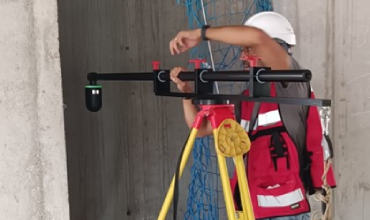
Elevator core verticality control and point cloud generation in Barcelona, Spain
Spain
The objective of the work is to know the deviations in the floor of an elevator core.
Our job is to survey the structure of the elevator core to determine the areas that come out of this tolerance to know which parts need to be regularized or if the structure of the elevator rails needs to be modified to know their cost.
European Regional Development Fund.
APLITOP S.L. has been a beneficiary of the European Regional Development Fund whose objective is to improve the use and quality of information and communication technologies and access to them and thanks to which it has optimized our commercial processes for the improvement of competitiveness and productivity of the company 2022. For this, it has had the support of the INNOCAMARA PROGRAM of the Chamber of Commerce of Malaga. "A way of making Europe".
Funded by the European Union NextGenerationEU.
APLITOP S.L. has benefited from the INTERNATIONAL MENTORING Programme to improve and consolidate its international positioning through the implementation of an International Action Plan. The programme is financed by European Next Generation-EU funds, as part of the Recovery, Transformation and Resilience Plan.
Compromiso con el Medio Ambiente
Midiendo el futuro con sostenibilidad. Implementamos medidas responsables para reducir las emisiones de CO₂ el desarrollo de nuestras soluciones