Our range of products allows us to develop or check a wide variety of Topography and Civil Engineering projects and include everything from field applications to powerful office applications.
Public Administration
- Land analysis for the location of infrastructure and public services
- Environmental impact studies
- Design and layout of roads, roads, and bike lanes
- Management of urbanization projects and development of residential areas
- Planning of parks, gardens, and public spaces
- Inspection and control of works
- Delimitation and monitoring of environmental protection areas
- Evaluation of the site and installation of wind and solar farms
- Generation of updated maps and parcel plans
- Regularization and titling of land and properties
- Maintenance and monitoring of water and sewerage networks
- Inspection and control of road infrastructures and bridges
Urban Planning and Development
Natural Resource Management
Cadaster and Property Management
Infrastructure Management
We can help you
Need help? Click on the following button to contact us and we will be happy to assist you.
Related products
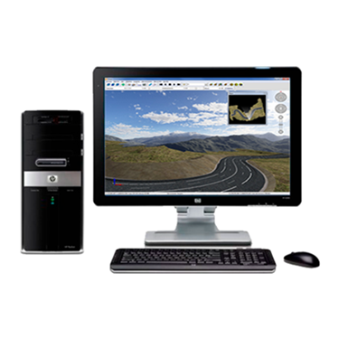
tcpMDT Standard

Software for surveying, terrain modeling, contours, profiles and volumes.

tcp PointCloud Editor

AI-powered point cloud software for surveying, engineering, architecture and design
Success Stories
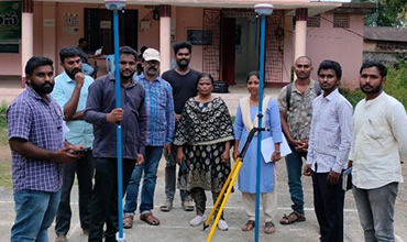
Cadastral surveying
Andhra Pradesh, India
The Revenue Department has drawn up an action plan for a comprehensive re-survey of lands across the state. It has prepared a report with elements on how to do this massive program that it wants to undertake for the first time in nearly 120 years.
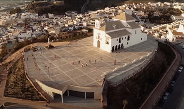
Point clouds from positioning with image in Malaga, Spain
Spain
Definition of platforms resulting from the works undertaken in the remodeling of the Cerro de la Ermita de los Remedios, location of steps and slopes and location of the columbarium. Knowledge of the real state of the building that constitutes the Hermitage.
European Regional Development Fund.
APLITOP S.L. has been a beneficiary of the European Regional Development Fund whose objective is to improve the use and quality of information and communication technologies and access to them and thanks to which it has optimized our commercial processes for the improvement of competitiveness and productivity of the company 2022. For this, it has had the support of the INNOCAMARA PROGRAM of the Chamber of Commerce of Malaga. "A way of making Europe".
Funded by the European Union NextGenerationEU.
APLITOP S.L. has benefited from the INTERNATIONAL MENTORING Programme to improve and consolidate its international positioning through the implementation of an International Action Plan. The programme is financed by European Next Generation-EU funds, as part of the Recovery, Transformation and Resilience Plan.
Compromiso con el Medio Ambiente
Midiendo el futuro con sostenibilidad. Implementamos medidas responsables para reducir las emisiones de CO₂ el desarrollo de nuestras soluciones