Aplitop - Solutions - Quarries and Mining

aplitop-spinning
Our experience, your best work tool.

Quarries and Mining

Innovation

Our technological base makes us attach great importance to I + D + i with direct application to the Topography sector.

Do we cooperate?

We offer solutions to meet the needs of all types of quarry and mine operations, both open-pit and underground.

Quarries and Mining

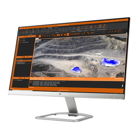
  • Tcp PointCloud Editor is an ideal application for processing point clouds generated from drone flights, generating digital elevation models, obtaining profiles, calculating volumes and much more.
  • MDT Standard is the best application for making all types of topographical plans with contours, comparative longitudinal and transversal profiles. It also allows you tocalculate the volume of tons extracted, design the annual management project for next year, compare the current and projected status, intrusion expert reports, etc.
  • In addition, with MDT Professional, you can design and modify land to executemanagement plans, design trails and access roads to quarry and open-pit mines, calculate the capacity of tailings dams, project extensions, prospecting studies of new production facilities, etc.
  • We also have field applications to perform topographic surveys of stockpiles, waste dumps or auxiliary mining facilities using GNSS and TcpGPS receivers. With them we can also stake out blasting, get inventories of material stock, etc.
  • Furthermore, we offer solutions for the implementation control of mining tunnels and underground excavations with TcpTunnel using total station or with TcpScancyr if a scanner is used.
Quarries and Mining

We can help you

If you have any specific questions about your needs, or if you already have it clear and want to buy the application, do not hesitate. Contact us and we will be happy to assist you.

Related products

TcpMDT Professional
TcpMDT Professional

All-in-one solution for Surveying and Civil Engineering projects

TcpScancyr
TcpScancyr

Analysis of tunnel data captured by terrestrial scanner

Tcp PointCloud Editor

Management of point clouds for surveying projects

Case Studies

Asturias (Spain)
Asturias (Spain)

In Asturias, after a period of adverse weather conditions, a very unique emergency situation occurs that involves great difficulty, with the need to use very specific technical equipment and qualified personnel for execution, due to the potential existing high risk.

Rovinij (Croatia)
Rovinij (Croatia)

In a camping site near Rovinij (Croatia), a great deal of work had to be taken, which almost 90% of the camping site changed completely. The problem was not the surveying of the new camping site for the surveying office that I work for, but the calculation of the volumes of earthworks for the contractor company.

Can we help you?