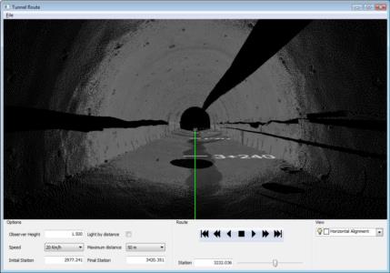
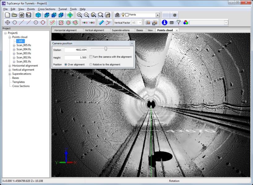
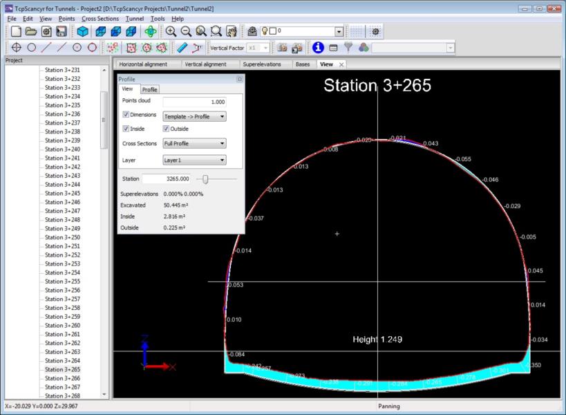
tcpScancyr
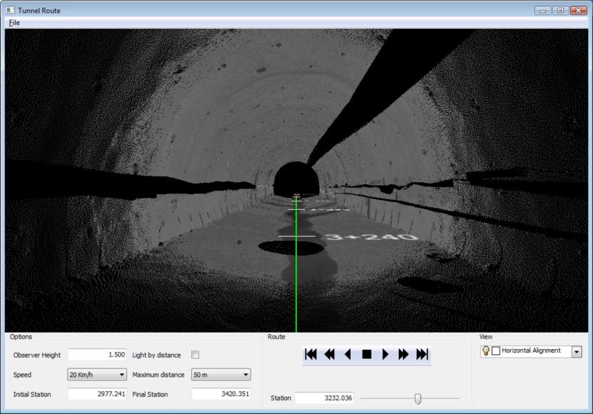
Point cloud analysis of road and rail tunnels.
About the product
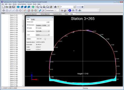
• Tunnel profile calculation for roads, railways and mines
• Defining Numeric Tunnel Sections, Graphically, or by Importing Files
• Works from ground scanner data of all major formats
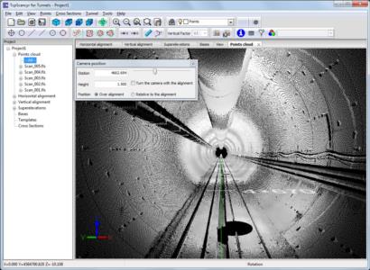
• Viewing and Cleaning the Point Cloud
• Customizable profile calculation and rendering
• Reports of areas and volumes, stakeout, deviation from the axis, etc.
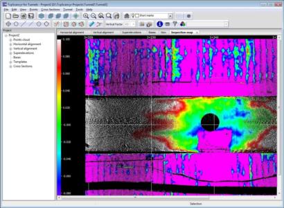
• Inspection maps and orthoimages
• Tunnel tour simulation and video generation
Solutions by Industry
Explore how our applications are used in your sector or industry.
Quarries and Mining
We offer solutions to meet the needs of all types of quarry and mine operations, both open-pit and underground.
BIM
Our software facilitates the exchange of survey and civil project data using industry OpenBIM standards such as IFC and BCF.
Civil Engineering
Solutions that facilitate the development of road projects, railways, tunnels, dams, power lines, pipes and all types of civil works.
Related products
tcp PointCloud Editor

AI-powered point cloud software for surveying, engineering, architecture and design
European Regional Development Fund.
APLITOP S.L. has been a beneficiary of the European Regional Development Fund whose objective is to improve the use and quality of information and communication technologies and access to them and thanks to which it has optimized our commercial processes for the improvement of competitiveness and productivity of the company 2022. For this, it has had the support of the INNOCAMARA PROGRAM of the Chamber of Commerce of Malaga. "A way of making Europe".
Funded by the European Union NextGenerationEU.
APLITOP S.L. has benefited from the INTERNATIONAL MENTORING Programme to improve and consolidate its international positioning through the implementation of an International Action Plan. The programme is financed by European Next Generation-EU funds, as part of the Recovery, Transformation and Resilience Plan.
Compromiso con el Medio Ambiente
Midiendo el futuro con sostenibilidad. Implementamos medidas responsables para reducir las emisiones de CO₂ el desarrollo de nuestras soluciones