Our products letyou use the geographic information of web services and open data, and generate results that can be easily integrated into corporate GIS.
SIG
- Worldwide coverage base maps and user layers
- Capture points, lines, and polygons with Android devices
- Editing user attributes
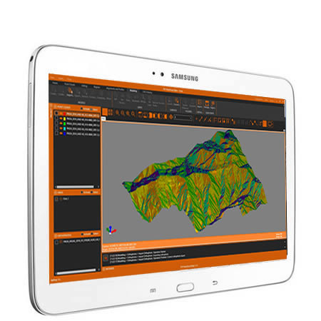
- Digital elevation models
- Analysis of slopes, orientations, and visibility
- Contours and profiles
- Cut and fill volumes
- Precise geospatial location of imagery
- Transformations between coordinate systems
- 2D to 3D conversions and vice versa
- Import and export of vector data in shape, GML and other formats
- Import and export of orthoimages and raster data in GeoTIFF and other formats
- WMS, WMTS, WCS, and WFS map web services
Data Capture
Terrain Analysis
Georeferencing and Digitization
Application Integration
We can help you
Need help? Click on the following button to contact us and we will be happy to assist you.
Related products

tcpMDT Standard

Software for surveying, terrain modeling, contours, profiles and volumes.
tcp PointCloud Editor

AI-powered point cloud software for surveying, engineering, architecture and design
European Regional Development Fund.
APLITOP S.L. has been a beneficiary of the European Regional Development Fund whose objective is to improve the use and quality of information and communication technologies and access to them and thanks to which it has optimized our commercial processes for the improvement of competitiveness and productivity of the company 2022. For this, it has had the support of the INNOCAMARA PROGRAM of the Chamber of Commerce of Malaga. "A way of making Europe".
Funded by the European Union NextGenerationEU.
APLITOP S.L. has benefited from the INTERNATIONAL MENTORING Programme to improve and consolidate its international positioning through the implementation of an International Action Plan. The programme is financed by European Next Generation-EU funds, as part of the Recovery, Transformation and Resilience Plan.
Compromiso con el Medio Ambiente
Midiendo el futuro con sostenibilidad. Implementamos medidas responsables para reducir las emisiones de CO₂ el desarrollo de nuestras soluciones