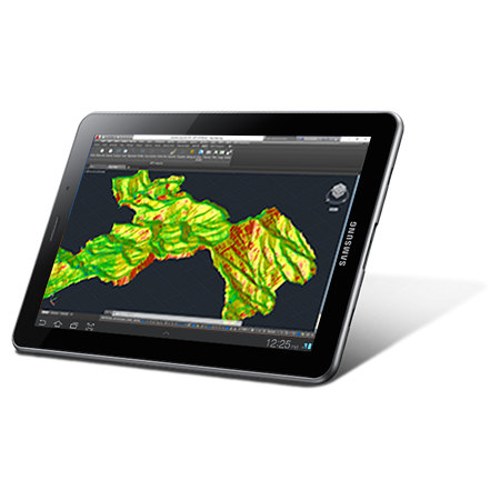
The land analysis functions of our software allow you to map slopes, orientations and visibilityas well as importing and exporting data from Geographic Information Systems The source data can be surveys, mapping, elevation models provided by Geographic Information Systems or even point clouds.
Environment
- Preparation of studies and preliminary projects
- Analysis of affected services
- Environmental impact analysis
- Generation of digital terrain models
- Contours and profiles
- Earthworks volumes
- Slope maps and orientations
- Visibility analysis
- Visualization and management of LIDAR or photogrammetry point clouds
- Importing and exporting vector data
- Importing and exporting orthoimages and meshes
- Map Web Services
Design and Planning
Environmental Impact Analysis
Geographic Information Systems
The geospatial data provided by Geographic Information Systems or created by applications such as ArcGIS, QGIS or gvSIG, as digital elevation models or meshes can also be utilised by our software. Orthophotos are inserted directly into their correct geographical location in the drawing, and images of WMS services can be extracted.
We can help you
Need help? Click on the following button to contact us and we will be happy to assist you.
Related products
tcpMDT Standard

Software for surveying, terrain modeling, contours, profiles and volumes.
tcpMDT Professional

Software for surveying, civil engineering, architecture and construction projects
tcp PointCloud Editor

AI-powered point cloud software for surveying, engineering, architecture and design
European Regional Development Fund.
APLITOP S.L. has been a beneficiary of the European Regional Development Fund whose objective is to improve the use and quality of information and communication technologies and access to them and thanks to which it has optimized our commercial processes for the improvement of competitiveness and productivity of the company 2022. For this, it has had the support of the INNOCAMARA PROGRAM of the Chamber of Commerce of Malaga. "A way of making Europe".
Funded by the European Union NextGenerationEU.
APLITOP S.L. has benefited from the INTERNATIONAL MENTORING Programme to improve and consolidate its international positioning through the implementation of an International Action Plan. The programme is financed by European Next Generation-EU funds, as part of the Recovery, Transformation and Resilience Plan.
Compromiso con el Medio Ambiente
Midiendo el futuro con sostenibilidad. Implementamos medidas responsables para reducir las emisiones de CO₂ el desarrollo de nuestras soluciones