Thanks to virtual reality technology we have made it possible for engineers to thoroughly inspect the site from any location, and, with augmented reality, technicians can analyse the project state of implementation in real time
Virtual Reality
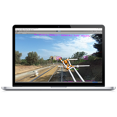
- Virtual reality technology allows engineers to thoroughly inspect the sitevirtually using 360º images, saving travel expenses to remote locations. We have also developed displaysfor terrain and tunnel tours from data generated by our applications
- We are working with low cost virtual reality headsets such as Google Cardboard and Samsung Gear VR, and professional systems based on Oculus Rift with Leap Motion sensor. 360º images can be captured from simple cameras like the Ricoh Theta S to sophisticated devices such as NCTechiStar, etc.
Augmented Reality
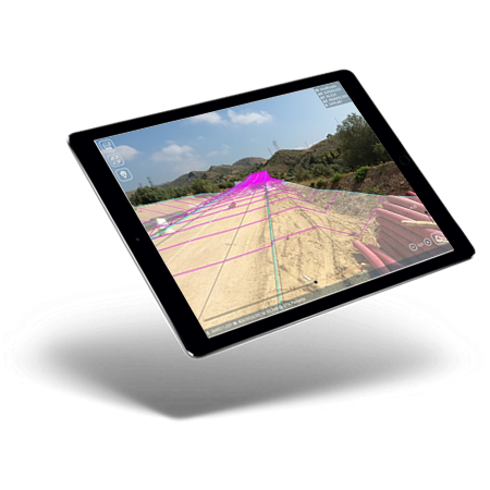
- Reality can be used by technicians at the site itself, so that with the help of special glasses or tablets you can analyse the project state of implementation in real time.
- The virtual model application allows you to examine a 3D model easily in a meeting room, with theability to move, scale and rotate objects in real time.
- We have developed software for tablets and smartphones with Android operating systems as well as augmented reality glasses such as Epson Moverio and Microsoft Hololens.
Request for Collaboration
APLITOP, as a technology-based company, meets the ideal conditions to participate in calls for R & D projects in collaboration with other companies: highly specialized human team, extensive distribution network, international project experience , location in Malaga, etc.
If you want us to study the possibility of participating in a project as a partner or subcontractor, and is related to the development of applications in the Surveying or Engineering sectors Civil, we will be happy to study your case.
Projects
Pandora
The PANDORA project has developed new technological solutions to facilitate the implementation of multiple applications in the life cycle of different use cases in infrastructure projects, which will improve both the acquiringand the exploitation ofinformation, representation and interpretation.
A solution based on LiDAR technology and high-resolution vision has been developed from 360º cameras that lets youobtain high added value information in environments without GNSS signal (tunnels, etc.), integrated into a platform that can be integrated into unmanned aerial vehicles (UAVs) and ground vehicles (UGV, off-road vehicles, etc.).
View details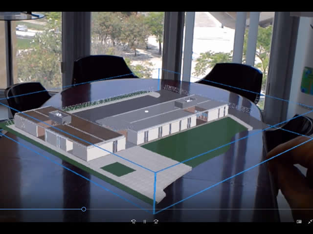
European Regional Development Fund.
APLITOP S.L. has been a beneficiary of the European Regional Development Fund whose objective is to improve the use and quality of information and communication technologies and access to them and thanks to which it has optimized our commercial processes for the improvement of competitiveness and productivity of the company 2022. For this, it has had the support of the INNOCAMARA PROGRAM of the Chamber of Commerce of Malaga. "A way of making Europe".
Funded by the European Union NextGenerationEU.
APLITOP S.L. has benefited from the INTERNATIONAL MENTORING Programme to improve and consolidate its international positioning through the implementation of an International Action Plan. The programme is financed by European Next Generation-EU funds, as part of the Recovery, Transformation and Resilience Plan.
Compromiso con el Medio Ambiente
Midiendo el futuro con sostenibilidad. Implementamos medidas responsables para reducir las emisiones de CO₂ el desarrollo de nuestras soluciones