
tcpGPS for Android
A complete solution for surveying work with GNSS receivers
About the product
- Compatible with the main GNSS receivers, check here:
list of compatible receivers - Base maps and projections with worldwide coverage
- Option to use web map services or CAD and GIS files as user layers
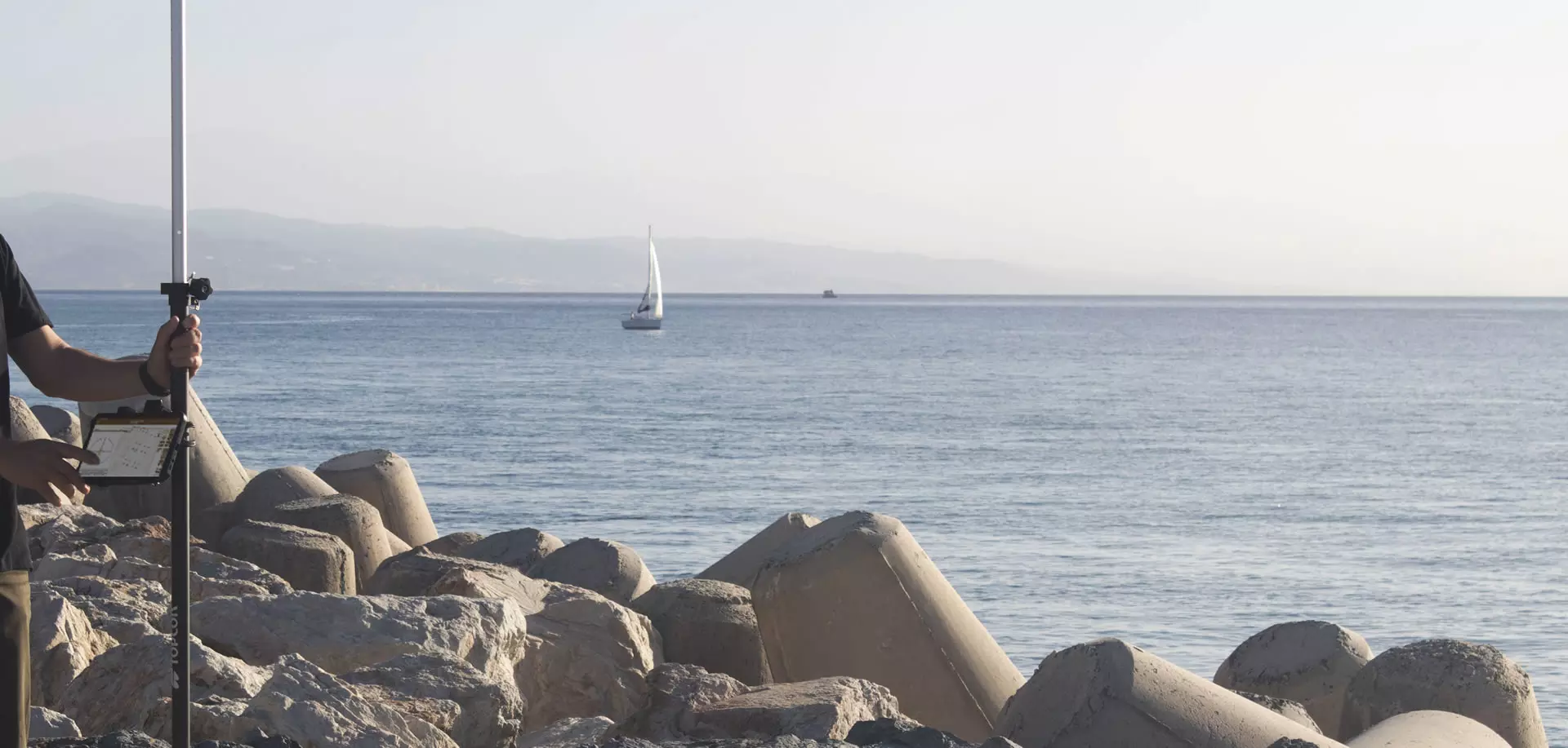
- Simple, precise surveying with capture of point, line and polygon objects
- Linking of photographs, voice notes and user attributes
- Stake-out of points, lines or polylines using map, compass and target with voice prompts
- Tools for drawing, splitting and merging plots, etc.
- Export of data to the cloud in multiple formats
- Optional module for working with surfaces, roads and BIM projects
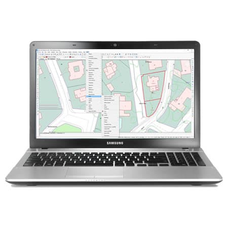
tcpGPS for Android screenshots
Explore screenshots and examples of the product in action
Solutions by sector
See how tcpGPS for Android adapts to the needs of your professional sector.
Cadastre
With our field applications you can survey plots using GNSS receivers, and with the desktop ones you design the subdivisions and integrate them with GIS and web map services.
View solution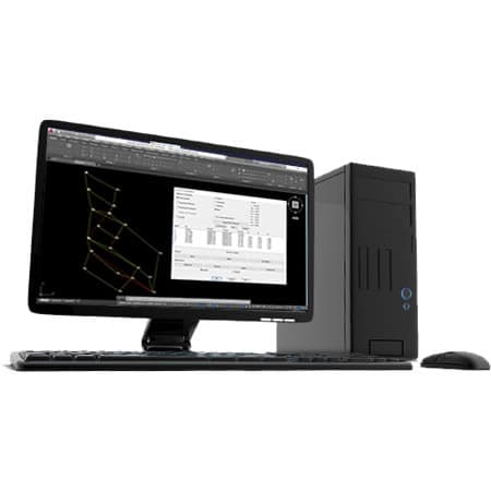
Surveying and Geodesy
Our applications make it very easy to carry out surveys with GPS and total station, as well as traverse adjustment and coordinate system transformations.
View solution
Solar Photovoltaic Energy
An ecosystem of solutions to optimize the office and field work of the engineering firms and EPCs that design and build photovoltaic plants.
View solution
Public Administration
Our applications are used by technicians from all kinds of national, regional and local administrations, as well as urban planning, public works, transport, water and sanitation, energy and other departments.
View solution
GIS
Our products let you use geographic information from web services and open data, and produce results that can be easily integrated into corporate GIS.
View solution
Agriculture
Solutions that simplify surveys, stake-outs, mapping, irrigation and drone analysis, enabling the efficient management of agricultural operations.
View solution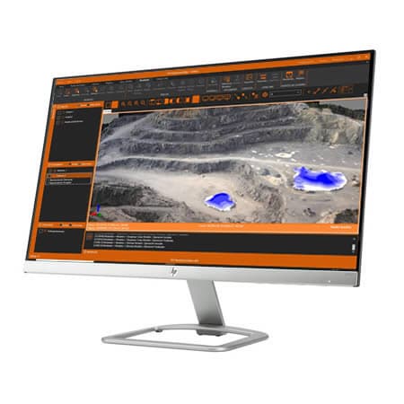
Quarries and Mining
We offer solutions to cover the needs of all kinds of quarries and mines, both open-pit and underground.
View solution
Building and Urban Development
In addition to terrain modelling tools, our software makes it easy to subdivide plots, design urban development roads, integrate with BIM and much more.
View solution
Civil Engineering
Solutions that streamline the development of roads, railways, tunnels, dams, power lines, pipelines and all kinds of civil works.
View solution
Water and Energy
Solutions to simplify the work of the technical offices of public or private companies in water supply, sanitation, gas, electricity, telecommunications, etc.
View solutionFrequently Asked Questions
Answers to common questions about tcpGPS for Android
tcpGPS for Android is a field application for surveys and stake-outs with GPS/GNSS receivers. It lets you capture survey data, work with maps and cartography, and stake out points and linear works, connecting field information with technical office workflows.
tcpGPS is used in plots, urban areas, infrastructure, civil works, cadastre, agriculture, energy, GIS and surveying. It is designed for professionals who need to capture accurate data in the field, document georeferenced elements and prepare useful information for analysis, design or stake-out.
tcpGPS can connect to GNSS receivers that support the NMEA standard. It also lets you configure different integrated or external devices via Bluetooth, TCP/IP or the Internet, working in base, rover or static mode with corrections and constellations such as GPS, GLONASS, Galileo, Beidou and SBAS.
tcpGPS lets you use base maps with worldwide coverage, WMS services and CAD or GIS files such as DXF, DWG, GML, KML, KMZ and SHP. It also includes EPSG geodetic systems organized by country and lets you define local coordinate systems.
With tcpGPS you can capture points, lines, polylines, polygons and plots, attaching photographs, voice notes, codes and user-defined GIS attributes. The collected data can be exported in multiple formats and shared from the application.
Yes. tcpGPS lets you stake out points, lines and polylines from the cartography through graphic selection or technical criteria. The application offers aids such as a map, compass, target, voice prompts and sounds to guide the stake-out directly in the field. The Professional version of the application also allows the stake-out of roads and other linear works.
tcpGPS exports data in multiple formats and, in its professional version, lets you work with LandXML, IFC, surfaces, roads and BCF. This way, the surveys, stake-outs and issues captured in the field can continue in CAD, GIS, BIM and tcpMDT workflows in the office.
Ready to try tcpGPS for Android?
Download the free trial version or request a custom quote for your company.