With our field applications, parcel surveys are carried out using total station or GNSS receivers, and with the desktop parcels are designed and integrated with GIS and web map services.
Land Administration
- Surveys with GNSS receivers
- Base maps and cartography in DWG, KML, GML, shape, etc.
- Capture point, linear, and polygon features
- Photos, voice memos, and user attributes
- Export to the cloud in multiple formats
- Conversion of plots and buildings
- Plot subdivision by area, façade length, parallel and other criteria
- Generation of plans and reports of areas, boundaries, and coordinates
- Plot dimensioning and annotation
- Analysis of occupation and expropriations
- Tools for drawing, editing, and presenting plans
- Digital terrain models and contour lines
- Orthophotos and photographs with position
- Importing and exporting GIS files
- Map Web Services
- Calculation of total station observations
- Traverse and network compensation
- Coordinate transformations
- Local systems
Fieldwork
Plot Subdivision
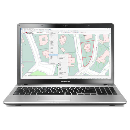
Cartography and GIS
Topographic Calculations
We can help you
Need help? Click on the following button to contact us and we will be happy to assist you.
Related products


Success Stories
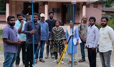
Cadastral surveying
Andhra Pradesh, India
The Revenue Department has drawn up an action plan for a comprehensive re-survey of lands across the state. It has prepared a report with elements on how to do this massive program that it wants to undertake for the first time in nearly 120 years.
European Regional Development Fund.
APLITOP S.L. has been a beneficiary of the European Regional Development Fund whose objective is to improve the use and quality of information and communication technologies and access to them and thanks to which it has optimized our commercial processes for the improvement of competitiveness and productivity of the company 2022. For this, it has had the support of the INNOCAMARA PROGRAM of the Chamber of Commerce of Malaga. "A way of making Europe".
Funded by the European Union NextGenerationEU.
APLITOP S.L. has benefited from the INTERNATIONAL MENTORING Programme to improve and consolidate its international positioning through the implementation of an International Action Plan. The programme is financed by European Next Generation-EU funds, as part of the Recovery, Transformation and Resilience Plan.
Compromiso con el Medio Ambiente
Midiendo el futuro con sostenibilidad. Implementamos medidas responsables para reducir las emisiones de CO₂ el desarrollo de nuestras soluciones