Development of software applications for the outdoor geometric definition based on 3D scanning techniques and digital photogrammetry.
TCPSTORM
Development of software applications for the outdoor geometric definition based on 3D scanning techniques and digital photogrammetry.
| Code: | IDI-20110529 |
| Program: | Colaboración Interempresas Nacional |
| Start date: | April 2011 |
| End date: | December 2013 |

Financing
Este proyecto contó con la ayuda en la modalidad de subvención y crédito del Centro para el Desarrollo Tecnológico Industrial (CDTI) del Ministerio de Economía y Competitividad, y del Fondo Tecnológico perteneciente al Fondo Europeo de Desarrollo Regional.

Links
Objectives
Mid-range scanning is a system increasingly used in public works as a substitute for complex surveying studies. This system has multiple advantages, as it provides more data volume, more accurately and in less time. The software used shows that viewing large point clouds can pose performance problems, they do not offer advanced filtering methods and none of them manage to solve the problem of generating a coherent and error-free mesh of triangles.
The objective of this project is to create a series of computer applications that reduce the time of manual editing in order to create three-dimensional models, by combining the technologies of processing points with laser scanner and terrestrial photogrammetry. The ultimate goal is to build a software tool that gives an exact representation of the scanned surface and calculation of theoretical and real sections as well as the comparison between both, in external scenarios.
Investigation Results
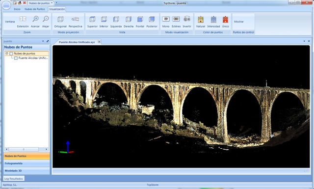
The developed application lets you manage very large point clouds, up to 1,200 million points, and combine several data points in local coordinates in one go in UTM global coordinates or something similar. Automatic point filters were implemented by colour, intensity, distance, angle, coordinates, categories and normal vectors.

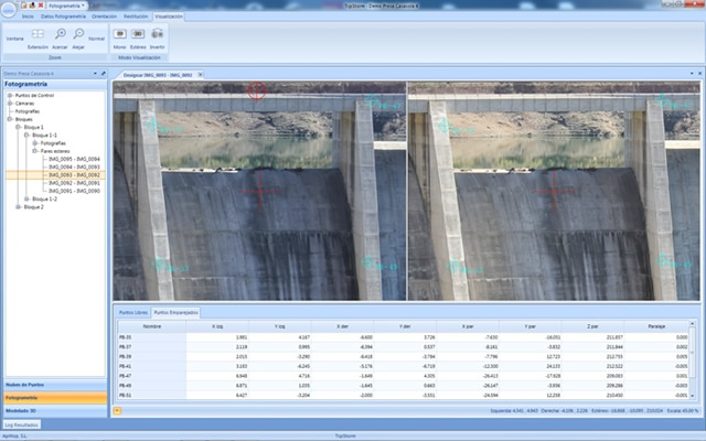
A module for the management of digital cameras and calibration was developed from photographs of a meshed board. In addition, the detection of interest points, the automatic pairing of interest points through correlation, the filtering of pairings by different heuristics and the automatic relative orientation were implemented.
Likewise, the calculation of absolute orientation was developed from 4 points in a pair, the external orientation of the images of a pair by the method of independent pairs and the external orientation of all the images of a block by means of compensation and adjustment by the ray beams method (aerotriangulation).
Finally, the stereoscopic vision of pairs of images was implemented using graphics cards with quad-buffer, high frequency monitor and active glasses, useful for orientation and restitution and the restitution on pairs of images oriented in mono or stereo mode.


