Shengxin Cathedral Scan in Guangzhou, China
| Company: | OmniSLAM |
| Location: | Guangzhou, China |
| Website: | www.omni-slam.com |
| Main Activity: | Development and manufacturing of high-precision 3D mobile laser scanners with SLAM technology and solutions to capture and replicate the real world in the digital domain with applications in surveying, geospatial information, digital twins and digital factories, supported by AI and robotics. |
Use Case
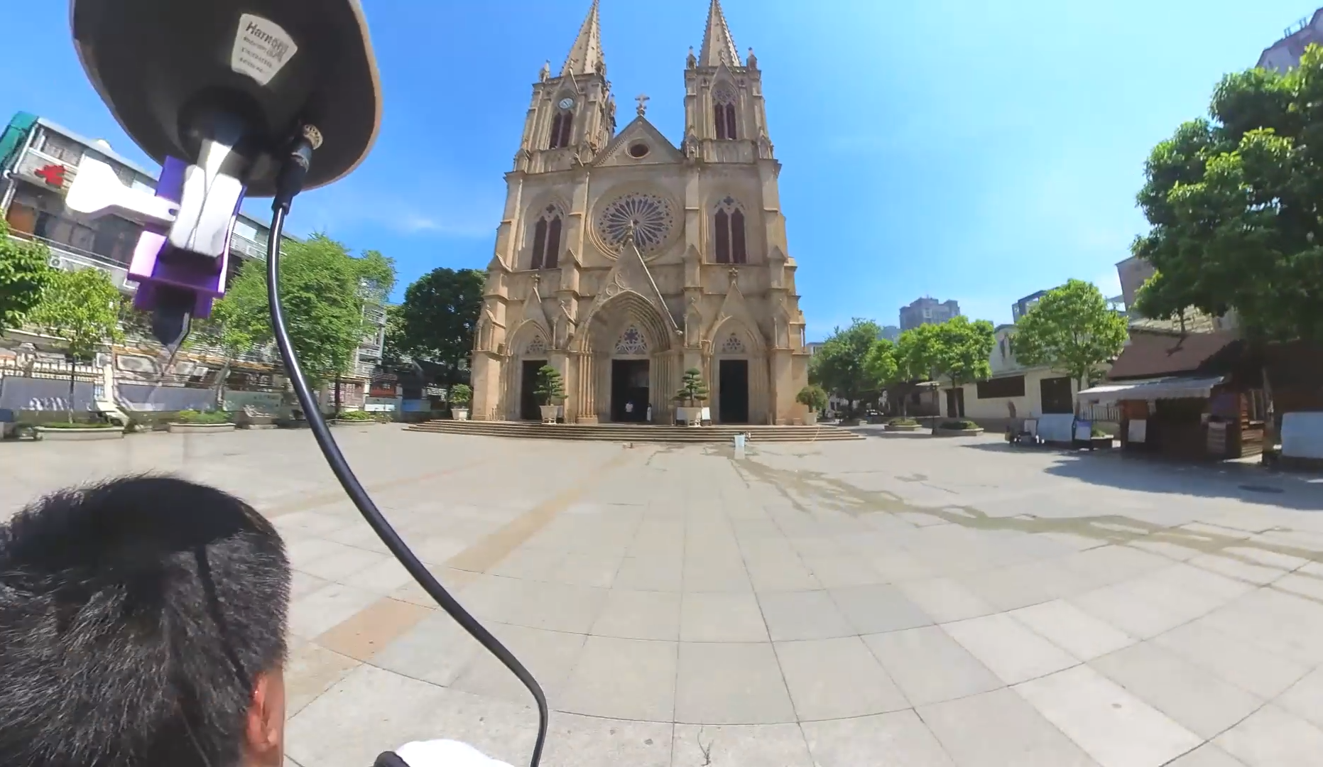
The Shengxin Cathedral and its urban surroundings in Guangzhou (China) form a highly complex monumental complex. To plan conservation work and facilitate its documentation, a complete survey was required, both exterior and interior of the building.
The objective was to obtain a digital twin of the complex in the shortest time possible, taking advantage of mobile scanning technologies. The technical challenge was to manage a massive volume of data - more than 600 million points in total, according to the processed files - and transform them into useful information for the engineering and architecture team.

Shengxin Cathedral and its urban surroundings in Guangzhou, China
The scanning was carried out with OmniSLAM's R8+ scanner, which allows you to traverse the area in just a few minutes while simultaneously capturing points and images. After processing the data in OmniSLAM software, three LAS files were imported into Tcp PointCloud Editor.
To focus the analysis, the area of interest was delimited and noise points were removed using elevation selections and other tools. The source files were merged into a single cloud, and subsequently a density filter was applied to remove points that were too close together (less than 1 cm).
Point cloud processing with Tcp PointCloud Editor
To distinguish different objects, Tcp PointCloud Editor incorporated an artificial intelligence model trained for outdoor scenes. The software automatically classified the cloud, distinguishing ground, buildings, trees and other categories. This classification was refined with advanced selection tools.

Automatic classification using artificial intelligence
The project also took advantage of other software functionalities. Quick profiles were generated to examine cross-sections of the cloud, distances were measured and objects were drawn with CAD tools.

Floor plan section generation for vectorization
The images captured with the scanner were imported along with their position and orientation, allowing examination of the 3D trajectory and inspection of panoramic photographs.

Interior inspection with 3D trajectory and panoramic images
Finally, the cloud was published so that collaborators could explore it.

- Fast capture of interior and exterior
- Efficient cleaning processes
- AI classification with assisted editing for consistent results
- CAD drawing tools on the point cloud
- Image integration for visual inspection
- Web publishing for consultation and collaboration
This project demonstrates how the combination of the OmniSLAM R8+ scanner and Tcp PointCloud Editor provides a comprehensive solution for the survey and exploitation of point clouds in surveying, heritage and civil engineering projects.

Web publishing of digital twin for consultation and collaboration
European Regional Development Fund.
APLITOP S.L. has been a beneficiary of the European Regional Development Fund whose objective is to improve the use and quality of information and communication technologies and access to them and thanks to which it has optimized our commercial processes for the improvement of competitiveness and productivity of the company 2022. For this, it has had the support of the INNOCAMARA PROGRAM of the Chamber of Commerce of Malaga. "A way of making Europe".
Funded by the European Union NextGenerationEU.
APLITOP S.L. has benefited from the INTERNATIONAL MENTORING Programme to improve and consolidate its international positioning through the implementation of an International Action Plan. The programme is financed by European Next Generation-EU funds, as part of the Recovery, Transformation and Resilience Plan.
Compromiso con el Medio Ambiente
Midiendo el futuro con sostenibilidad. Implementamos medidas responsables para reducir las emisiones de CO₂ el desarrollo de nuestras soluciones