Outdoor Street Survey and Point Cloud Classification in Málaga, Spain
| Company: | Stonex |
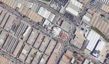
| Location: | Málaga (Spain) |
| Website: | https://www.stonex.it/ |
| Name: | Stonex Team |
| Position: | Technical Surveying Team |
| Main Activity: | Development of surveying technologies and solutions |
Use Case
The project consisted of an outdoor street study along a 200-meter urban road in Málaga, Spain. The purpose was to efficiently map the area for construction and maintenance applications. The survey was carried out with a single 10-minute scan using the Stonex X120 GO SLAM scanner, capturing a detailed point cloud dataset of the street environment.
The main challenge involved efficiently documenting the complex urban environment, including buildings, trees, vehicles, and street lighting, using advanced scanning technology. A solution was required that would not only capture the precise geometry of the space, but also automatically classify different urban elements to facilitate analysis and maintenance planning.

Point selection tools for data cleaning and filtering.
After acquisition, the raw point cloud was imported into Tcp PointCloud Editor, where the first step was cleaning and filtering. Using polyline selection, points outside the area of interest were hidden and noisy points below ground level were removed through an elevation-based filter.

Elevation-based filtering to remove unwanted points below ground level.
To ensure consistent density and quality, a density filter was applied, balancing point distribution throughout the dataset. Additional isolated points that did not represent significant surfaces were also removed.

Density filtering and isolation of scattered points for data quality improvement.
Next, a clean version of the point cloud was duplicated for further processing. The project highlight was the use of an advanced AI-powered classification tool integrated into the upcoming version of Tcp PointCloud Editor. This tool automatically classified points into various categories such as ground, buildings, trees, vehicles, and street lighting.

AI-powered automatic classification of urban elements.
Although automatic classification worked well at distance, close inspection revealed some misclassifications and unclassified points. To address this, manual editing tools were used. The proximity selection function allowed selection of connected points based on spatial proximity, enabling correction of classification errors such as misclassified vegetation. For more complex cases, like objects close to each other (e.g., a streetlight near a tree), a clustering selection tool was applied to precisely isolate specific elements before reassigning their class.

Final classified point cloud showing different urban element categories.

- This project showed how the upcoming AI classification capabilities of Tcp PointCloud Editor, combined with manual refinement tools, can transform raw street scanning data into structured and meaningful models.
- The cleaning, filtering, and classification workflow facilitates efficient extraction of useful information and supports precise documentation and analysis for urban infrastructure projects.
- The ability to separate and classify multiple urban elements enhances decision-making and maintenance planning based on detailed 3D data.
- AI-powered automatic classification significantly reduces processing time while maintaining high accuracy for urban element identification.
- The combination of automatic and manual tools provides flexibility to handle complex urban environments with mixed object types and proximity challenges.
European Regional Development Fund.
APLITOP S.L. has been a beneficiary of the European Regional Development Fund whose objective is to improve the use and quality of information and communication technologies and access to them and thanks to which it has optimized our commercial processes for the improvement of competitiveness and productivity of the company 2022. For this, it has had the support of the INNOCAMARA PROGRAM of the Chamber of Commerce of Malaga. "A way of making Europe".
Funded by the European Union NextGenerationEU.
APLITOP S.L. has benefited from the INTERNATIONAL MENTORING Programme to improve and consolidate its international positioning through the implementation of an International Action Plan. The programme is financed by European Next Generation-EU funds, as part of the Recovery, Transformation and Resilience Plan.
Compromiso con el Medio Ambiente
Midiendo el futuro con sostenibilidad. Implementamos medidas responsables para reducir las emisiones de CO₂ el desarrollo de nuestras soluciones