Corsica, France

| Company: | Sostremetries |
| Location: | Vic (Spain) |
| Web: | sostremetries.cat |
| Name: | Andreu Alvarruiz Serrano |
| Position: | Photogrammetry and LiDAR Manager |
| Main Activity: | Design of workflows to automatically identify peaks from LiDAR point clouds and surface models derived from photogrammetric flights. |
| Distributor: | Mendilur |
| Website: | mendilurposition.com |
Use Case
How many peaks in Corsica exceed 2000 meters in altitude?
The island's traditional list of two thousand is based on the names that appear on topographic maps at a scale of 1:25,000. As a result, many prominent peaks without a toponym are excluded, while minor protrusions with their names are included for historical reasons. From a topographical point of view, this is not consistent.
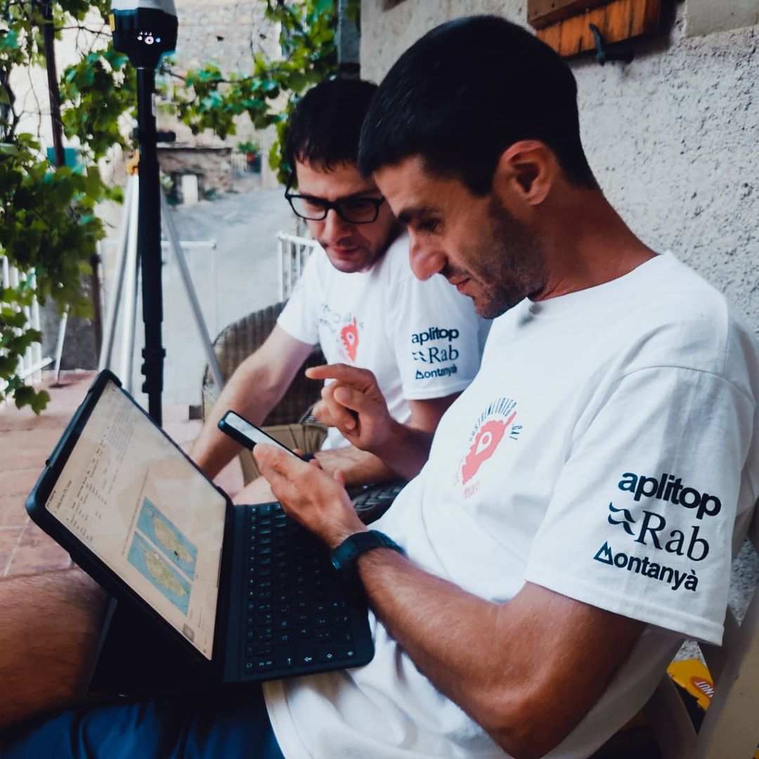
Sostremetries' challenge is to draw up a new list with strictly topographical criteria. To do this, we took advantage of the recent publication of the LiDAR coverage of the Institut National de l'information géographique et forestière (IGN France), with a minimum density of 10 points/m². This coverage allows detecting any maximum altitude in the terrain and calculating its prominence automatically.
The main challenge is that on the most remote peaks, the key ridge can be several kilometers away, requiring huge amounts of LiDAR data to be analyzed for a comprehensive search. A direct approach would exceed the storage capacity of any computer, so efficient data processing was needed.

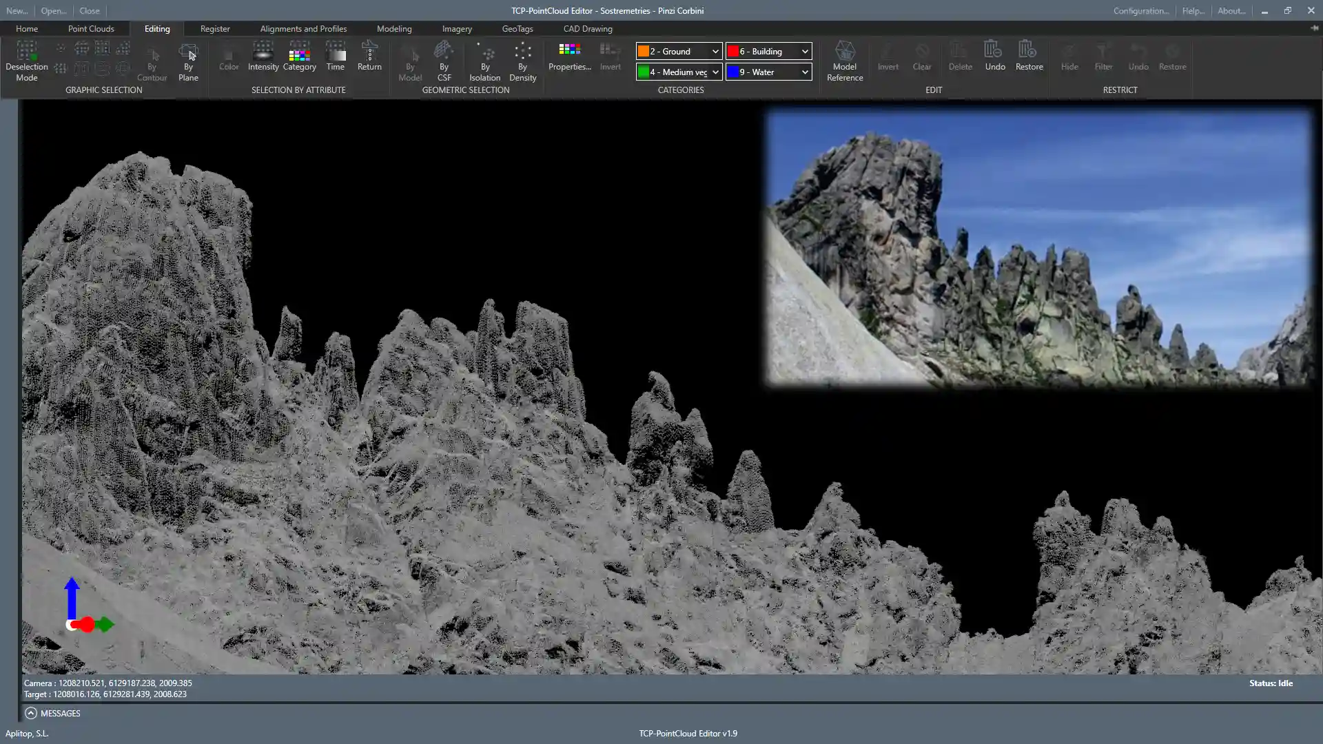
View of the east face of the Pinzi Corbini using the LiDAR HD point cloud published by IGN France.
The actual photograph highlights the level of detail of LiDAR. Photo: Association GHISONI-Oriente.
The first step was to filter the LiDAR point cloud published by IGN France to distinguish the terrain from other elements such as vegetation, summit crossings, or even animals. Only the points classified as terrain were used to generate the digital elevation model.
To handle large volumes of data without overloading computational resources, tcp PointCloud Editor allows you to apply altitude filters, automatically eliminating all points below 1850 m, the threshold necessary to be able to calculate prominences of at least 100 m safely. This filtering significantly reduces the amount of data to be processed and facilitates the efficient calculation of prominences.
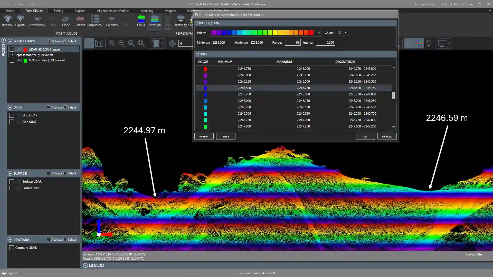
In cases where the prominence of a summit is uncertain, tools such as tcp PointCloud Editor allow you to analyze detailed profiles in the original point cloud. Its front orthographic view, with the fixed Z-axis, ensures an accurate comparison between hills. In addition, the generation of contour lines provides additional visual validation and allows accurate estimation of the uncertainty at the elevations.

Identification of the col that defines the prominence of Punta Orlandino thanks to the classification of the point cloud by elevation and activating the vertical Z-axis constraint in a frontal orthographic view.
- The previous processing of the data allowed us to reduce the field campaign to only about 30 peaks and their respective hills, focusing on those points where LiDAR did not guarantee the surpassing of the salience and isolation thresholds.
- In addition, GNSS observations in the field served as validation of the survey, combining the accuracy of a high-density digital model with on-the-ground checkpoints.
- Beyond this study, the ability to generate surfaces with tcp PointCloud Editor offers additional applications, such as determining snow thicknesses or monitoring glacial retreat by comparing LiDAR coverage from different years. In point clouds without color information, the detection of lakes in the data reveals the presence of snow at the time of capture since, without snow, the laser pulse would not have returned.

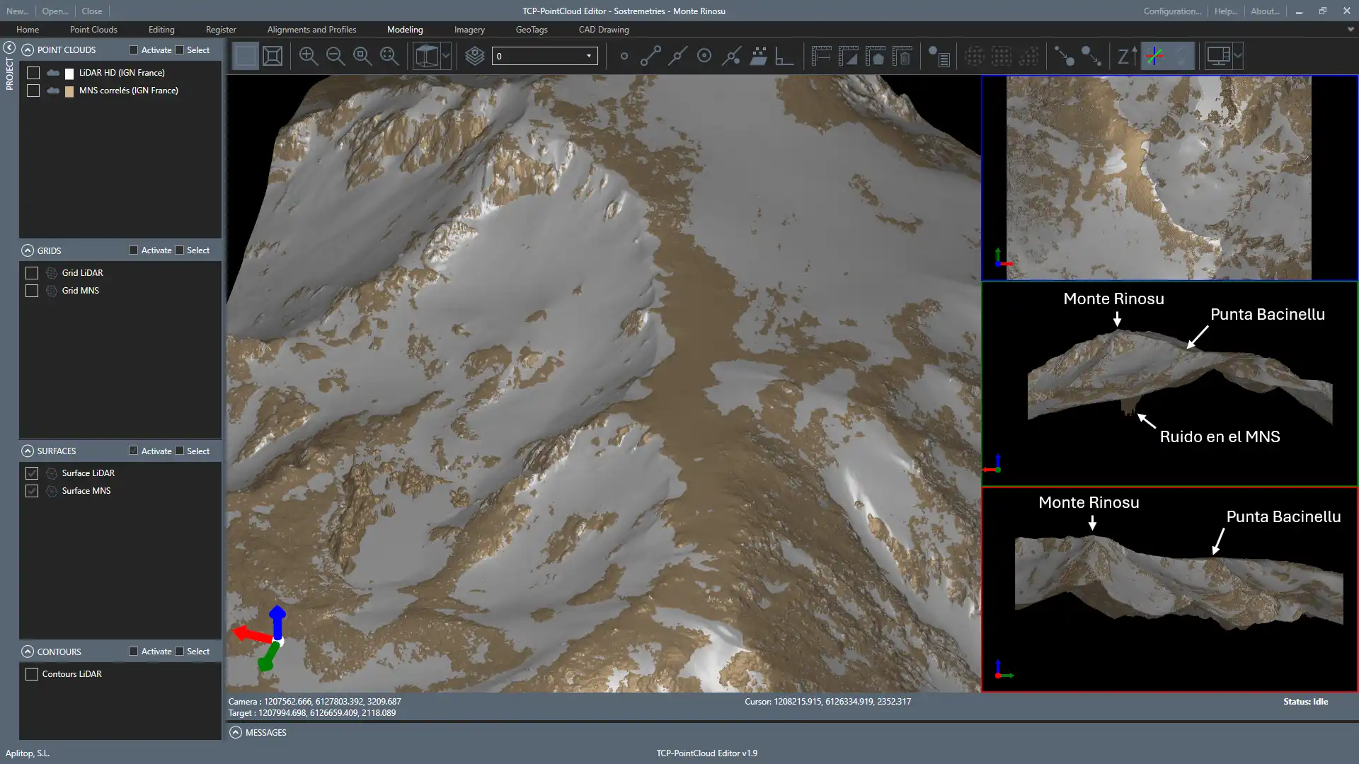
Superposition of a surface model generated from the IGN France HD LiDAR point cloud (white) and a surface model derived from the correlation of aerial images from a photogrammetric flight of the same French institution (brown).
Thanks to this view, we have visual confirmation that the terrain was covered with snow during a LiDAR flight without color information. In the lower left corner is the Lavu di Bastani or Lac de Bastani, where you can see the noise caused by correlation errors on the water. The return of LiDAR points in the lake confirms the presence of snow cover.


