
Tcp PointCloud Editor
Tcp PointCloud Editor
Enhance your point cloud workflow
About Tcp PointCloud Editor
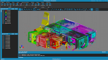
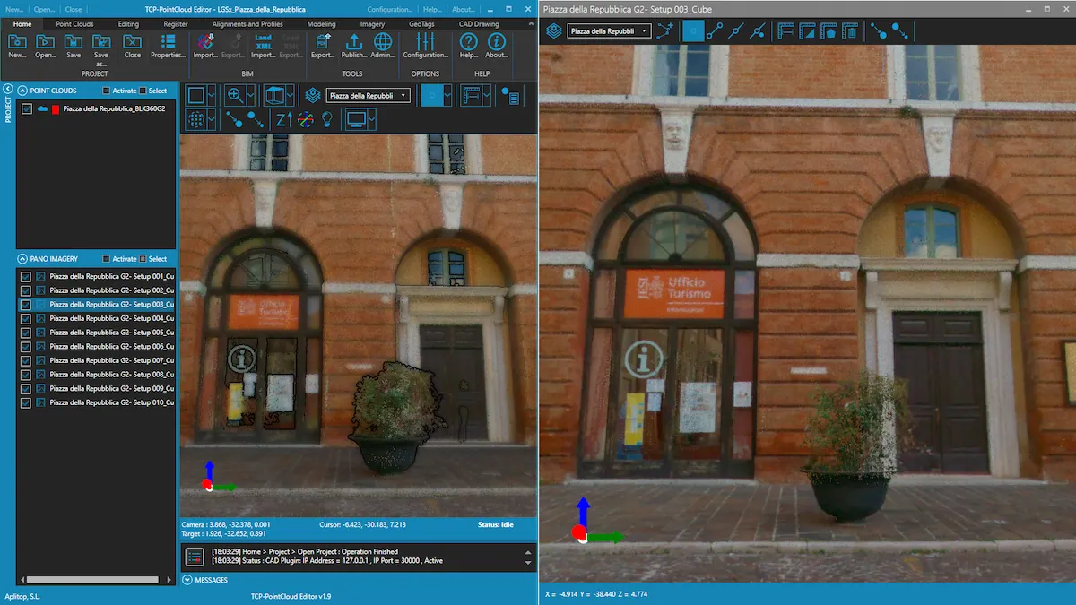
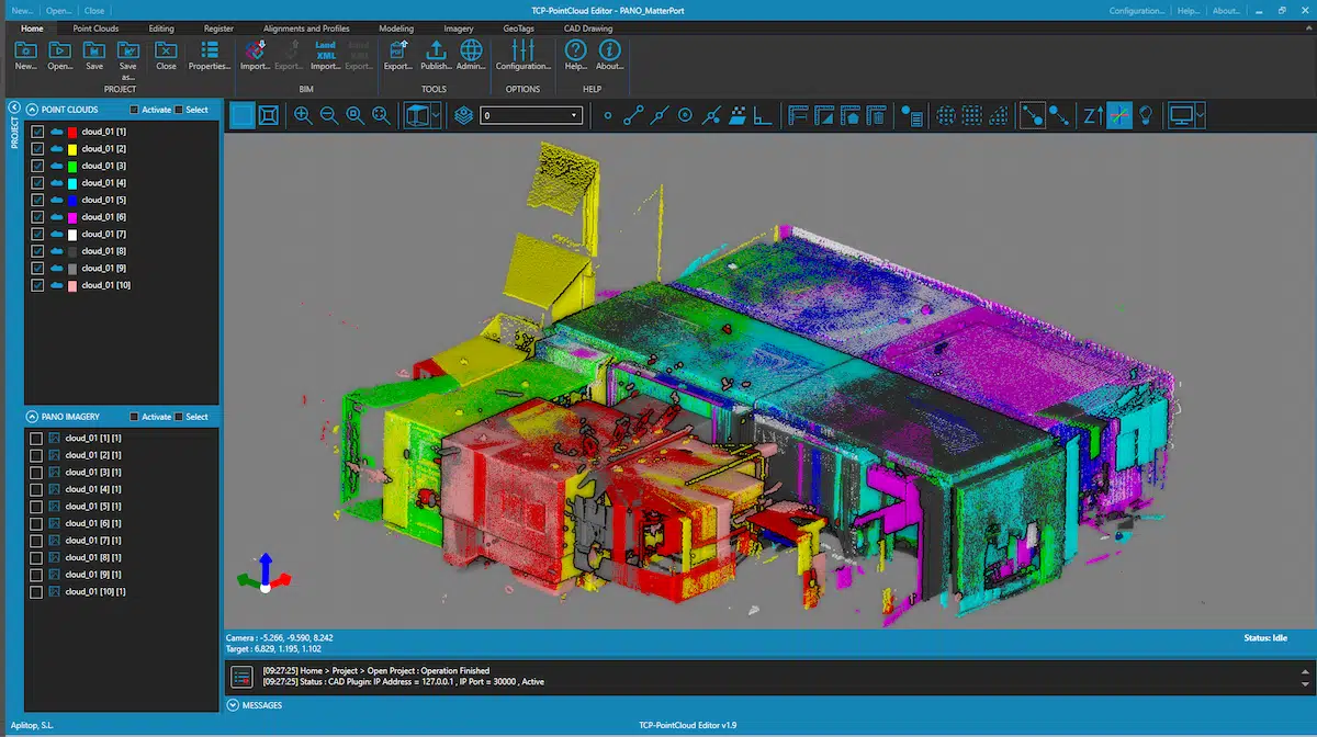
Standalone application that allows to display, edit and analyze point clouds and images from SLAM, LiDAR, mobile apps and drones.
Aplitop’s expertise meets the latest advances in point cloud technology and provide a new version for surveyors, engineers, designers, architects and planners.
Main features
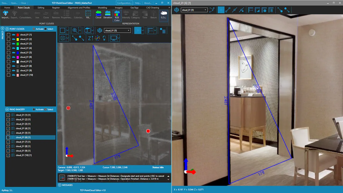
- Import images from E57 files
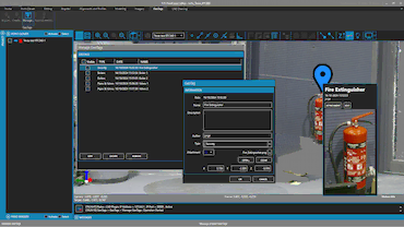
- Drawing and measuring in the image viewer
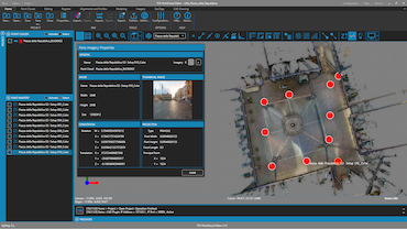
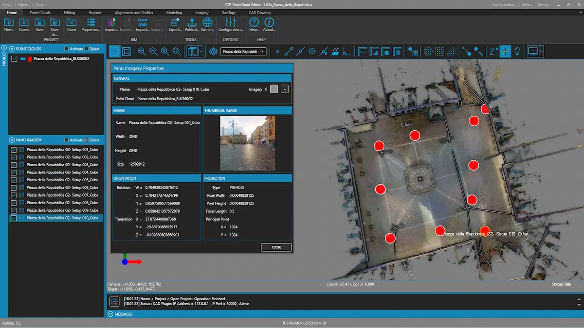
- Import points, images and geotags from Leica Geosystems LGSx files
- Management of geotags


European Regional Development Fund.
APLITOP S.L. has been a beneficiary of the European Regional Development Fund whose objective is to improve the use and quality of information and communication technologies and access to them and thanks to which it has optimized our commercial processes for the improvement of competitiveness and productivity of the company 2022. For this, it has had the support of the INNOCAMARA PROGRAM of the Chamber of Commerce of Malaga. "A way of making Europe".
Funded by the European Union NextGenerationEU.
APLITOP S.L. has benefited from the INTERNATIONAL MENTORING Programme to improve and consolidate its international positioning through the implementation of an International Action Plan. The programme is financed by European Next Generation-EU funds, as part of the Recovery, Transformation and Resilience Plan.
Compromiso con el Medio Ambiente
Midiendo el futuro con sostenibilidad. Implementamos medidas responsables para reducir las emisiones de CO₂ el desarrollo de nuestras soluciones