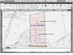
Bring to market MDT 5.3
Geodesy, integration with Google Earth and web services of maps
•AutoCAD 2010 in 32 and in 64 bits Compatible, also the previous versions from AutoCAD 14 and the CADs of low cost (BricsCAD and ZWCAD).
•New functions to work with the different systems of coordinates, including datums support, projections and common geoids. With the geodesic calculator it is possible to turn coordinates and drawings of ED-50 to ETRS-89.
• Access to maps services with Internet (Web Map Services) from the CAD, service which is also offered by, for example Catastro, PNOA, SIGPAC and others, inserting co referenced images.
• Communication with Google Earth, so it is possible the exportation of the current information as well as the insertion of the image that is being visualized in the drawing automatically.
• New Sight device of terrain and road with improved navigation and additional effects.


