7 min read
Can a point cloud help determine whether a mountain qualifies as a 3,000-meter peak? For years, the Sostremetries team has been surveying and studying the Pyrenees to answer this and other questions with reliable data. In 2026, their work led to the confirmation of Agulla Sud de Malavesina as a newly recognized 3,000-meter peak, following a process that combined LiDAR point cloud analysis using tcp PointCloud Editor with high-precision GNSS measurements in the field.
The Pyrenean 3000ers campaign by Sostremetries combines LiDAR data analysis using tcp PointCloud Editor with GNSS field measurements to accurately assess summits above 3,000 meters throughout the Pyrenees. In 2026, this work confirmed Agulla Sud de Malavesina as a new 3,000-meter peak in Catalonia.
Aplitop contributes to the project through tcp PointCloud Editor, which is used to process and analyze LiDAR point clouds before determining which areas require direct field verification.
The Pyrenean 3000ers: Surveying the Pyrenees Using Consistent Criteria
Determining which summits in the Pyrenees actually exceed 3,000 meters might initially seem to be a simple matter of elevation. However, the reality is considerably more complex.
This is one of the challenges addressed by The Pyrenean 3000ers, a project led by Sostremetries to establish a new list of the Pyrenees’ 3,000-meter peaks based on consistent surveying criteria.
To be included on the list, exceeding an elevation of 3,000 meters is not enough. The prominence of each summit must also be assessed. This is the difference in elevation between the summit and the col connecting it to higher ground.
The project establishes a minimum prominence of 10 meters for a summit to be considered independent.
This requires detailed analysis of summits, cols, ridgelines, and small elevation differences across a mountain range covering more than 55,000 km².
Sostremetries combines two complementary stages in its work: preliminary analysis of available data and, where necessary, direct field verification using GNSS equipment.
From LiDAR Analysis to Field Surveying
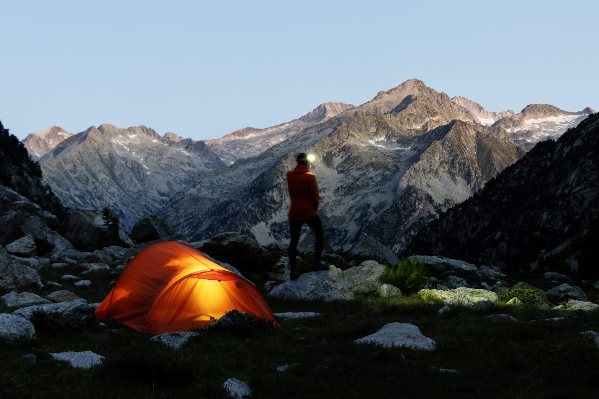
Before climbing a summit, there are many hours of work in front of a computer screen.
During preparations for the 2026 campaign, Sostremetries used tcp PointCloud Editor to process and analyze LiDAR point clouds from different areas of the Pyrenees.
The aim is not to replace field measurements, but to make full use of the available information to identify where measurements are needed and exactly what must be verified.
Point clouds make it possible to analyze terrain in three dimensions, identify potential summits, and examine the geometry of their surrounding cols. When the differences are clear, some candidates can be confirmed or ruled out during this stage. When the results are too close to the established threshold, the work continues in the field.
In this way, LiDAR analysis becomes a tool for planning a much more precise surveying campaign.
How tcp PointCloud Editor Helps Analyze a Summit
Throughout the project, Sostremetries has used different tools available in tcp PointCloud Editor to interpret point clouds and address very specific situations.
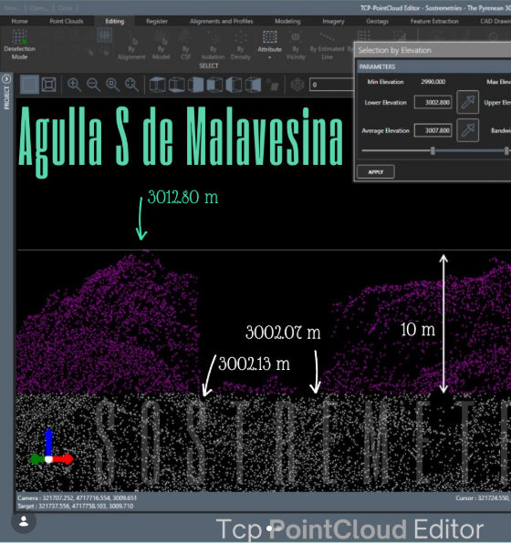
One of the most important is selection by elevation ranges, which can be used, for example, to check whether a summit meets the minimum prominence requirement of 10 meters established for inclusion on the list. By isolating specific elevation ranges, the team can visualize the relationship between a summit and its potential cols and check whether the required elevation difference exists.
Visualizing point clouds using RGB information also helps identify another factor that can affect the conclusions: snow. Snow covering a summit or col can cause LiDAR data to indicate an elevation higher than the actual ground surface.
Visualization features such as Eye Dome Lighting (EDL) also help improve terrain interpretation and identify elements that are not part of the mountain’s natural surface, such as cairns, stone bivouac shelters, or certain noise points.
Sostremetries has also used profiles, point cloud comparison, surface triangulation, orthographic views, and manual point editing to examine locations where the interpretation is not straightforward. Aplitop previously documented part of this methodology during the early stages of The Pyrenean 3000ers.
These are commonly used tools in point cloud processing, but here they are applied to a very specific challenge: determining whether a difference of just a few meters is enough to change how a mountain is classified.
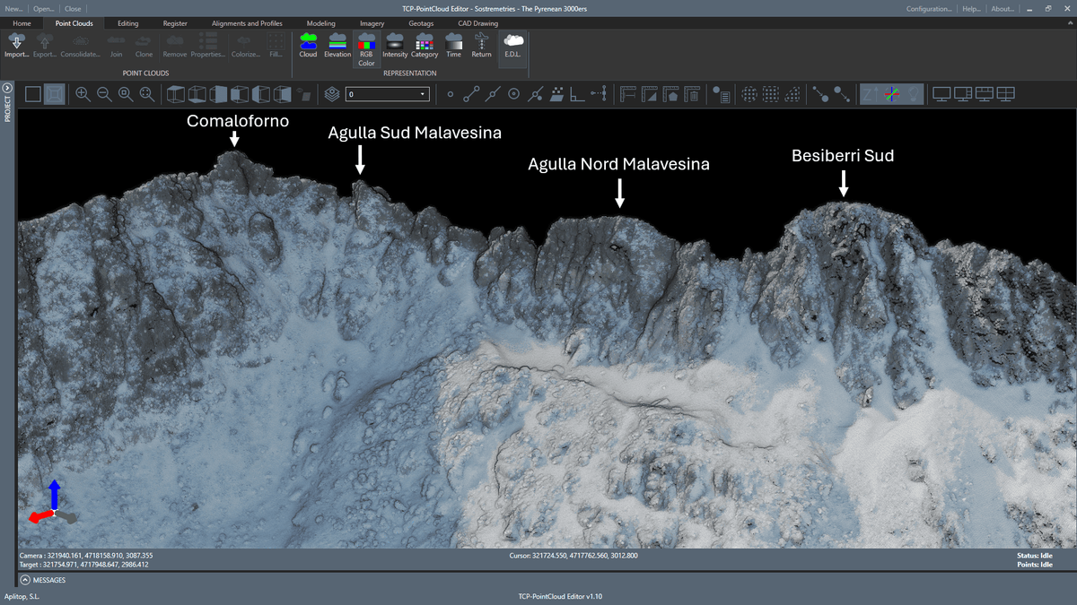
Agulla Sud de Malavesina: A Question of Just a Few Meters
One of these cases was Agulla Sud de Malavesina, located in the Besiberri massif in Vall de Boí.
The summit had been the subject of uncertainty for years. Previous measurements placed its prominence at approximately 9 meters, very close to the 10 meters required for it to be considered an independent 3,000-meter peak. However, the margin of error associated with those measurements prevented a definitive conclusion.
Analyzing LiDAR data with tcp PointCloud Editor made it possible to examine the geometry of the summit and its surrounding cols beforehand. The analysis confirmed that this was one of the locations requiring direct measurement: its prominence was too close to the threshold to reach a conclusion based solely on the available data.
The next step was to climb the mountain.
From Point Clouds to GNSS Measurements
On July 5, 2026, the Sostremetries team surveyed Agulla Sud de Malavesina using two Emlid Reach RS4 GNSS receivers.
One receiver was set up as a base station on Comaloforno. The second was used to measure both the highest natural point of Agulla Sud de Malavesina and the key col that determines its prominence.
Results were conclusive:
- Summit elevation: 3,012.9 m
- Key col elevation: 3,001.9 m
- Prominence: 11.0 m
The difference exceeds the minimum requirement of 10 meters. Agulla Sud de Malavesina could therefore be added to the list as a new 3,000-meter peak, increasing the number of summits in Catalonia meeting this criterion from twelve to thirteen.
The field measurements established an elevation of 3,012.9 meters for the summit and 3,001.9 meters for the key col.
Just one meter above the established threshold was enough to resolve a question that had remained unanswered for years: Agulla Sud de Malavesina meets the requirements and joins the list as a new 3,000-meter peak in the Catalan Pyrenees.
Technology That Helps Identify Where to Measure
The Pyrenean 3000ers demonstrates an unconventional application of point clouds, but it also reflects a fundamental reality in surveying: having more data does not eliminate the need to interpret the terrain correctly.
Preliminary analysis with tcp PointCloud Editor enables Sostremetries to work with large LiDAR datasets, identify potential summits, assess their prominence, and rule out cases that can be resolved directly during office processing.
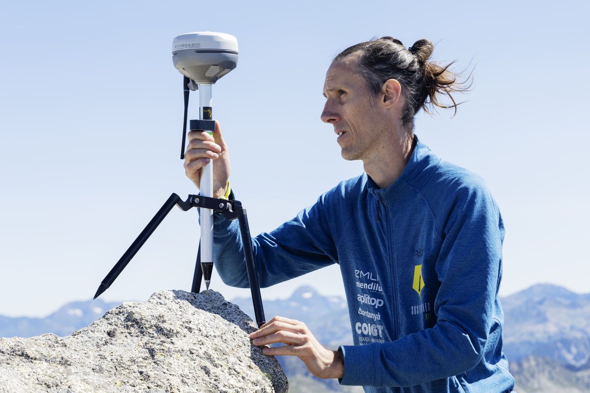
However, it is the technical expertise, experience, and meticulous work of the Sostremetries team that turn this data into meaningful conclusions.
Technology helps ask the right questions. Then, finding the answers requires climbing the mountain.
In the case of Agulla Sud de Malavesina, this combination of point cloud processing and high-precision GNSS measurements has resolved a question that had remained open for years.
And added another name to the list of the Pyrenees’ 3,000-meter peaks.
The Pyrenean 3000ers continues to analyze summits throughout the mountain range, aiming to establish a list based on consistent criteria and measurements. During this process, some mountains traditionally considered 3,000-meter peaks may no longer meet the requirements, while other summits may be added following more precise analysis.
At Aplitop, we would like to thank Sostremetries for trusting our technology as part of a project that combines surveying, mountaineering, and an extraordinary dedication to gaining a more accurate understanding of our geography.