Forest Survey and Biomass Estimation in the Dolomites, Italy
In a forest survey in the Dolomites, Tcp PointCloud Editor processed 135 million SLAM and UAV LiDAR points to classify terrain and vegetation, generate surfaces, contours and profiles, and support biomass estimation.
Project challenges
This project focused on conducting a detailed forest study in the Dolomites, located in northern Italy. The main objectives were to map a large forested area, analyze the terrain in detail, and estimate available biomass to support better forest resource management.
The challenging topography of the area and dense vegetation required an advanced and versatile surveying approach. The project needed to capture precise data of both terrain and vegetation in a complex mountainous region, where traditional surveying methods presented significant limitations.
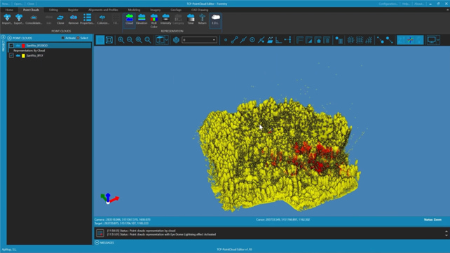
Visualization and representation of point clouds captured during the forest survey in the Dolomites.
Solutions
To capture the necessary data, Stonex used a combination of two technologies: a SLAM scanner (X120GO) and a UAV-mounted LiDAR system (XFLY). Both datasets, totaling around 135 million points, were imported and processed using Aplitop's tcp PointCloud Editor.
The workflow began with visualization and fusion of both point clouds. Next, the team applied noise reduction filters to clean the dataset and used classification tools to separate terrain from vegetation.
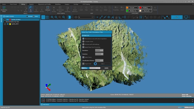
Application of the Cloth Simulation Filter (CSF) algorithm to extract terrain points from vegetation.
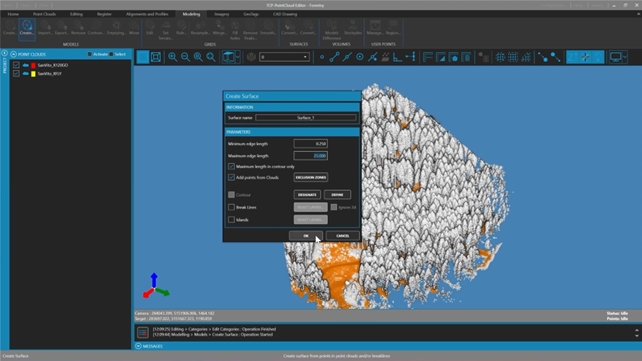
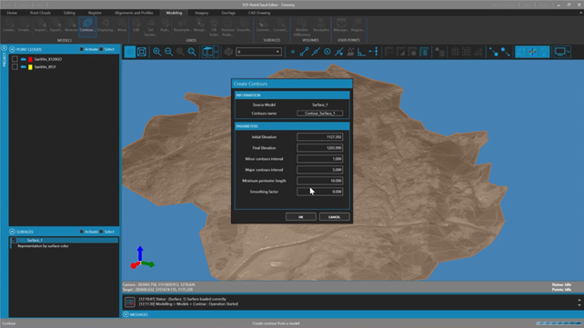
Ground points were extracted using the Cloth Simulation Filter (CSF) algorithm, followed by creation of a triangulated surface model. To enhance analysis, smoothed elevation models and detailed contour lines were generated. tcp PointCloud Editor also facilitated elevation mapping and creation of intensity histograms to support biomass estimation.
Generation of triangulated surface model from classified terrain points.
Creation of detailed contour lines for topographic analysis of forest terrain.
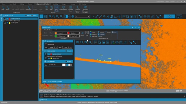
Generation of quick profiles for detailed analysis of topography and vegetation.
Benefits
The combined use of SLAM and UAV LiDAR technologies allowed the team to achieve centimetric precision in just 8 to 10 minutes of data collection per scan.
tcp PointCloud Editor proved to be a powerful tool for managing and processing large datasets with precision and efficiency.
The software enabled rapid and reliable terrain modeling, resulting in accurate contour lines and elevation profiles.
This process significantly reduced both fieldwork and post-processing time, while providing valuable insights for biomass analysis and forest planning.
Have a similar project?
Tell us about your project and we will help you find the ideal surveying solution.