Drone and Mobile LiDAR Ground Survey in Balao, Ecuador
Success story in Ecuador showing how TcpMDT Standard was used to process drone and mobile terrestrial LiDAR data for a 50 km road project, creating terrain surfaces, contours, cut and fill volumes, and plan and profile drawings.
Project challenges
The project consists of topography and the design of 50 kilometres of track, using a drone survey and a mobile terrestrial lidar system.
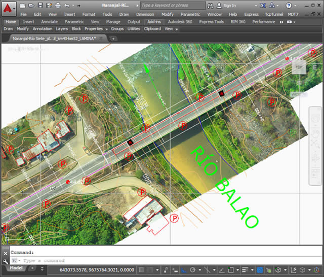
Drawing with orthoimages inserted
Solutions
The TcpMDT software was used to obtain the topography of a road section of approximately 50 kilometers.
TcpMDT allows to work with surfaces generated by programs that process the drone images, and it helps to complete the topography in all the required area, guaranteeing the precision required by an engineering project.
Once the topography and the final digital terrain model are generated, it is easy to continue working within the MDT to carry out the road design.
It is easy to create all the road elements necessary to project the road, make cut and fill volume calculations and draw the plan and profile sheets from the triangulated surface.
All that is needed is to follow step by step the menu of the Tcp MDT.
Benefits
It was very easy to create the surface and generate the contour lines, thanks to the well-structured menu that allows to process step by step the information obtained from the field.
In addition, the software allows combining information obtained with conventional methods (such as Total Station) with data acquired with modern methods such as LiDAR or drone.
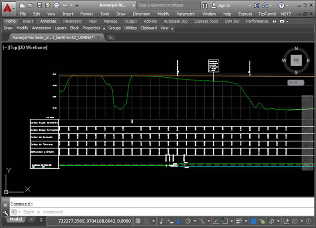
Terrain profile and project’s grade line
Have a similar project?
Tell us about your project and we will help you find the ideal surveying solution.