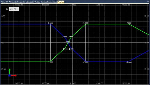
As with the previous elements, the superelevation can also be saved in IFC format and viewed in the Road Viewer.
In this way, the elevation representation of the existing superelevation in the selected IFC file will be shown in the “Superelevation” tab.
The superelevation on the left will be displayed in green and the superelevation on the right in blue and can be viewed in the following illustration its representation.
Moreover, as with the vertical level, you can set the representation scale through the “Edit > Drawing scale” option on the menu.
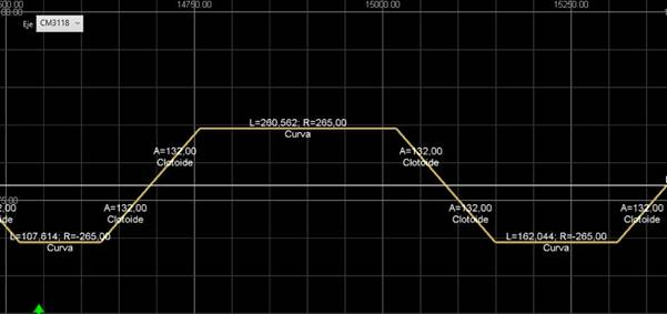
In addition, the viewer, as it features the axis, also shows the Contour Diagram as additional information. The information in this diagram cannot be found in the IFC file but is easily calculated using the plan alignment.