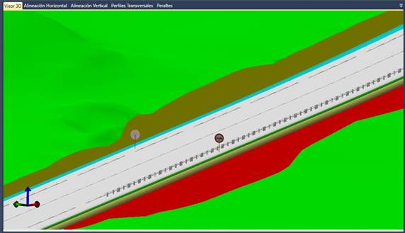
The 3D Viewer tab will enable you to see the existing surfaces in the IFC file (including earthworks: cuts and fills), in addition to the different pavement layers associated with each project alignment (if defined), road markings and signage (both spot and linear signs). A new layer will be created with the name of each surface or pavement layer on which it is to be drawn.
In addition, the properties associated with the surfaces, road surfaces and signs will be shown.
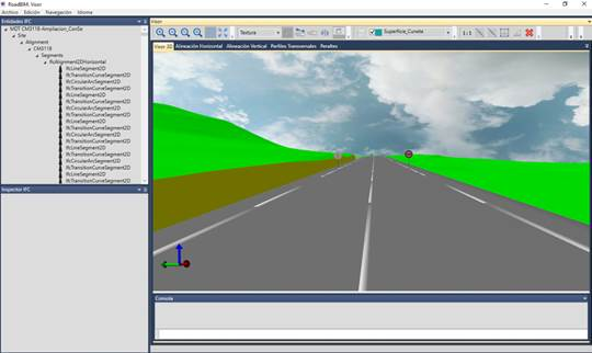
It is also possible to activate (using the Edit menu or the keyboard shortcut: Control + S) a Skybox as the background of the 3D view.