This command allows the conversion and/or transformation of coordinates stored in ASCII files or other different formats: GPX (GPS eXchange Format), KML (Keyhole Markup Language) and W84 (geographic coordinates file of the application TcpGPS).
In the case of GPX file, waypoints, tracks and routes are analysed. For KML the labels analysed are <Point>, <LinearRing>, <LineString> and <Polygon>.
When selecting a W84, GPX or KML file, the geographic coordinates system WGS84 is established at source.
For ASCII files the formats allowed are as follows:
n x y z
n x y
n,x,y,z
n,x,y
n;x;y;z
n;x;y
where
n : number or name of the coordinate tuple.
x y z : components of the coordinate tuple.
Coordinates can be projected, geocentric or geographic. The correspondence of each element of the tuple according to the type of coordinates is:
Projected
x : East
y : North
z : Orthometric or ellipsoidal altitude
Geocentric
x : X
y : Y
z : Z
Geographic
x : Latitude
y : Longitude
z : Ellipsoidal or orthometric altitude
A space is not admitted as a field separator for this type of coordinates.
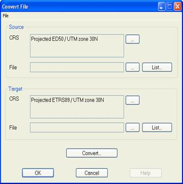
To perform a coordinate conversion you must first establish the properties of the source and target systems (see section Coordinate System Configuration). To do this you have to click the button  located to the right of the corresponding CRS box.
Next, at the bottom of each section, you have to select the source file, which contains the coordinates to be converted and can have any extension, and the target file, which will be created with the new coordinates and extension TXT or PUN. You should bear in mind that all the information existing in the latter will be deleted.
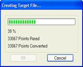
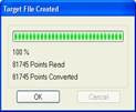
Once all the parameters are established, click the Convert… button to start the process. The following window will be displayed:
The process can be stopped at any time by clicking the Cancel button.
The number of points of the target file will be that indicated on the line Points Converted.
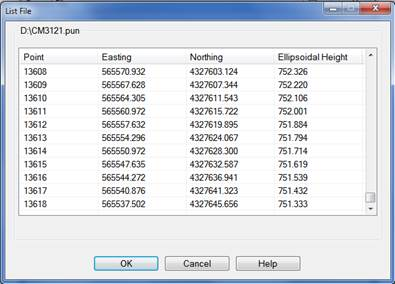
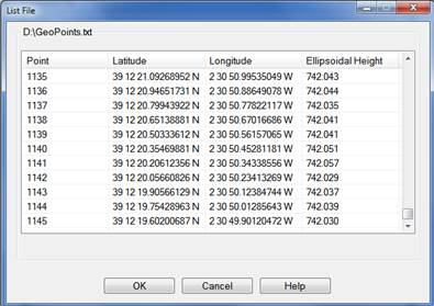
Once the conversion has been carried out, the file can be viewed by pressing the List…button, an option which is also available to the source data, except for GPX and KML files.