Coordinate System Configuration |
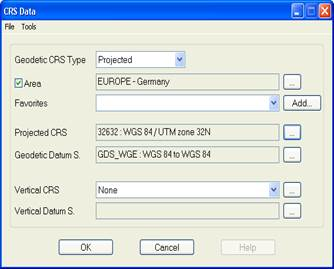
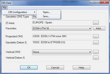
The various options presented by the program to perform the coordinates conversions and/or transformations require the prior configuration of the source and target systems. These systems consist of a combination of the elements mentioned in the previous sections (geodetic CRS’s, datum shifts, etc.). The following window lets you establish the configuration values of these parameters:
Geodetic CRS type: Indicates the type of coordinates. These can be Geographic, Geocentric or Projected.
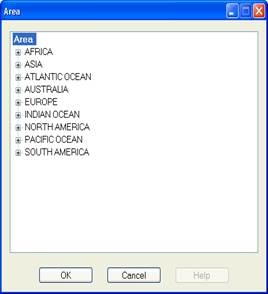
Area: If you activate this box and select a country by clicking the button  on the right, this is used as a filter in the CRS´s selection and the datum shifts.
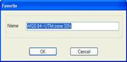
Favourites: Shows the list of the predefined coordinate systems for the selected area. These configurations are saved in the folder Geodesy\STS\Continent-Country. The program allows user to add new configurations by clicking the button Add….
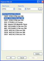
Geographic CRS (Geocentric or Projected): Name of the geodetic coordinate reference system. You have to select from a list by clicking the button .
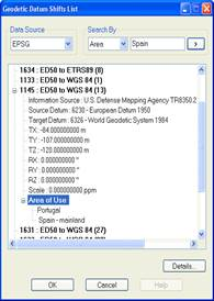
Geodetic Datum Shift: Name of the geodetic datum shift. You have to select from a list by clicking the button . In the event of different datum shifts with the same name appearing, you can use the Area of Use field to specify the area within the country selected.
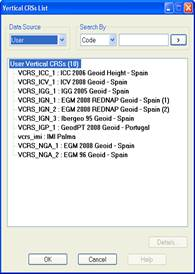
Vertical CRS: Name of the vertical coordinate reference system. This is optional and is only meaningful for geographic and projected reference systems. You have to select from a list by clicking the button  .
.
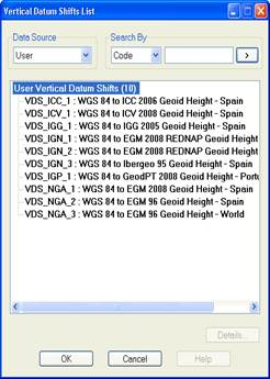
Vertical Datum Shift: Name of the vertical datum shift. It is only meaningful if you have selected a vertical datum. You have to select from a list by clicking the button .
Apart from these fields, the system configuration screen presents a menu of options to let you set default settings and change the format for the import and export of geographical coordinates.
As stated previously in the Favourites section, the system configurations are stored in ASCII files with an STS and they include the CRS parameters' values. To manage files of this type, in addition to the Favourites section, the options Load and Record are included on the menu Files > CRS configuration .
The format of this type of files is as follows:
Geodesic CRS Type
Geodesic CRS Code
Geodesic Datums Transformation Code
Vertical CRS Code
Vertical Datums Transformation Code
For CRSs and vertical datum transformations the symbol ‘?’ is established if they have not been defined.
It is worth highlighting that in the case of the Geodetic Calculator, when loading and recording a file of this type, the source and target systems are read and stored:
Source Geodesic CRS Type
Source Geodesic CRS Code
Source Geodesic Datums Transformation Code
Source Vertical CRS Code
Source Vertical Datums Transformation Code
Target Geodesic CRS Type
Target Geodesic CRS Code
Target Geodesic Datums Transformation Code
Target Vertical CRS Code
Target Vertical Datums Transformation Code