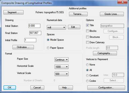
Presents a segment on screen (see Segments commands), that is to say, the possibility of drawing a complete profile containing all the information on grade line, superelevations, longitudinal profiles, curvatures, etc. If one only wishes to draw the terrain, the Profiles > Draw Simple Profile command should be used.
Once the command has been executed, the following dialog box is displayed, whose characteristics are described below: