This command is used to easily set out a roadway without the need to define the segment fully. It would be ideal for setting out a section with the platform and a few simple cut and fill slopes.
At first it requests the terrain cross-section profiles file and then the horizontal alignment, either graphically or by selecting it from the file.
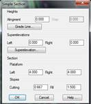
After selecting the files, the following window is displayed for defining the characteristics of our section type.
Heights: Indicate the height of our road or extract the height from the vertical alignment selected. Also, if the vertical alignment file is selected, a positive or negative increment may be applied to the height calculated in the station to be set out.
Superelevation: Indicate the superelevation to apply to both sides of the horizontal alignment, similarly it can be established according to the selected superelevation file.
Section: Defines the basic parameters of our section type.
·Platform: Left and right platform length.
·Slopes: Slopes to apply in the case of cut and fill.
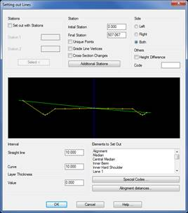
Once all the setting out values are established the following window will be displayed to specify the elements we wish to set out in the section type created, this option will be similar to that explained in the list of lines.
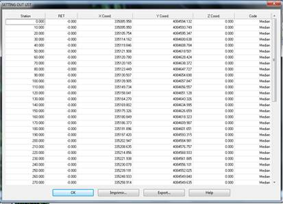
Once the dialog box is validated the final setting out result is displayed.