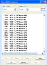
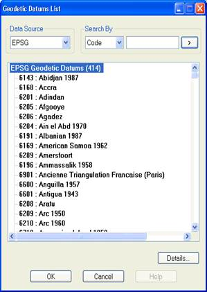
Displays the list of the projected CRS’s included in the EPSG database. Also lets you edit, delete and create new user CRS’s.
Each line of the list includes the code and name of the CRS separated by a colon.
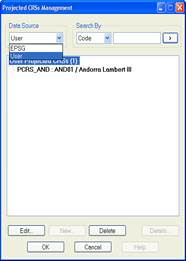
The dropdown list of the Data Source section lets you change the EPSG data query to a user data query and vice versa.
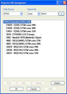
In the Search By section you can filter the query data by Code, Name and Area. The last option is only available for EPSG data. The name of the area (continent, country, etc.) must be specified in English. You have to enter the search string in the box on the right and click the  button. In the case of searching by code, it will only display the result if the code in question exists in the database, whereas in the search by name and area, it will display all the CRS’s whose name or area of use contains the string entered.
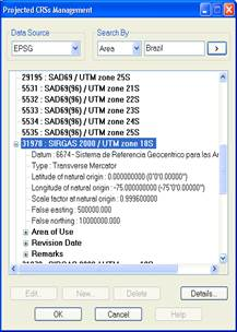
By double-clicking a CRS from the list, its properties are displayed: Datum, Projection Type, Projection Parameters and Area of Use, Revision Date and Remarks.
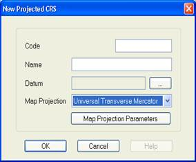
New user CRS’s can be created. The data initially requested and which are common to all Projected CRS’s are:
Code: An alphanumeric string of up to 16 characters is allowed.
Name: An alphanumeric string of up to 64 characters is allowed.
Datum: Select from the list displayed by clicking the button  .
.
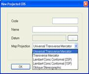
Projection: Type of projection of the CRS. The projections admitted are:
Universal Transverse Mercator (UTM)
Transverse Mercator (TM)
Lambert Conic Conformal (1SP)
Lambert Conic Conformal (2SP)
Oblique Stereographic
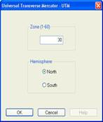
When you click the Projection Parameters button, depending on the type selected, the following data will be requested:
Universal Transverse Mercator (UTM)
The UTM Zone must be between 1 and 60.
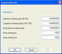
Transverse Mercator (TM)
Latitude and longitude must be specified in decimal degrees and False easting and False northing in metres.
The valid range for latitude is from -90° to 90° and for longitude from -180° to 180°.
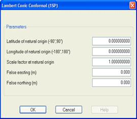
Lambert Conic Conformal (1SP)
Latitude and longitude must be specified in decimal degrees and False easting and False northing in metres.
The valid range for latitude is from -90° to 90° and for longitude from -180° to 180°.
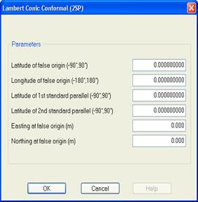
Lambert Conic Conformal (2SP)
Latitude and longitude must be specified in decimal degrees and Easting at false origin and Northing at false origin in metres.
The valid range for latitude is from -90° to 90° and for longitude from -180° to 180°.
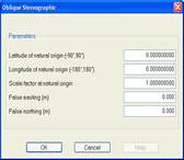
Oblique Stereographic
Latitude and longitude must be specified in decimal degrees and False easting and False northing in metres.
The valid range for latitude is from -90° to 90° and for longitude from -180° to 180°.