The distribution of earthworks throughout the road’s route can be analyzed using this option. Also, with a series of tools, the user can carry out different types of movements of materials to find minimum heights and obtain a list with all earthworks carried out and the cost of each one.
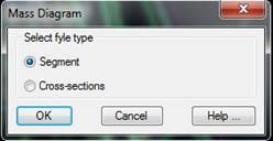
When this command is executed it gives the option to work in two ways, from a segment or from two cross-section files (two different states of the same terrain).
At the end of the process, the command will request that the information be saved in a file with a DMS extension. The rest of the commands related to the Mass Diagram work with this file type.