The purpose of this command is to copy the longitudinal profile on the gradient between given stations. This tool may be very useful for automatically adapting the gradient al to the terrain between given stations; for example, in the case of intersections.
With this in mind, we must initially have drawn the longitudinal profile with the associated grade line, then we execute the command and MDT will ask us to designate the profile and the grade line. Once the elements have been designated, we enter or designate the initial and final station between which we wish to adapt the grade line.
An example is then shown of the adaptation of the grade line between to specific stations.
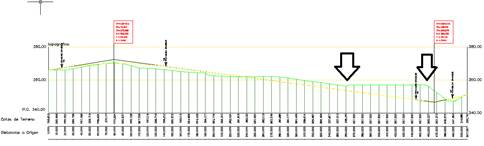
Before executing the command:
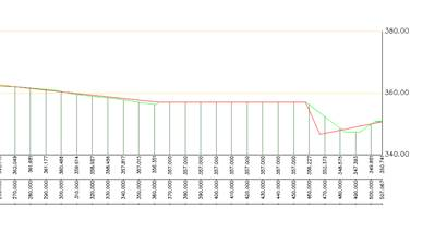
After execution of the command and marking the designated stations with the arrows: