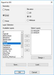
This command allows us to export a drawing to ESRI shapefile (* .SHP), Geographic Markup Language formats of the Open Geospatial Consortium (* .GML) or (*.GEOJSON). Initially we request the file where the information will be stored and then the following window will appear where all the information to be imported is managed.
Geometry: In this section you indicate how you want to import the selected entities. You can export them as Points, Lines or Areas.
Additionally, we have several different options to export in 2D or 3D:
·2D: files are exported ignoring dimensions.
·3D: files are exported in 3D, so that each vertex can have a different dimension.
·Attributes: in the associated attribute file, an ELEVATION field is created, containing the dimension value for each entity, provided it is consistent. Otherwise, it should be the value 0.
Layer Selection: We indicate the layers on which the elements are situated which we wish to export. We have the possibility of moving to the right the layer of layers selected or designatng them graphically.
Save: By pressing this button we will save the layer configuration selected in a file.
Load: By pressing this button we will be able to recover the configuration of layers selected.
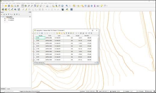
The number of exported entities will be indicated once the process has ended. If no objects of this type of geometry are found in the layers selected, an error message appears and the process will need to be repeated using the correct data.
The resulting files can be opened using GIS applications such as ArcGIS, QGIS and gvSIG.