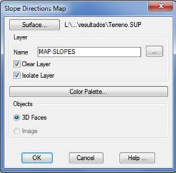
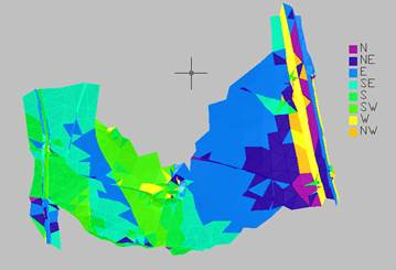
This command draws a map based on the current surface, assigning a different color to each triangle according to the orientation of its slope with regard to the cardinal points. The options available the same as the ones available in the Maps/Render > Draw Height Map command. The default interval and color configurations can be edited using the Map Configuration, Slope Dir. button.
Objects: The drawing of the directions map can be executed as AutoCAD 3D Faces entities or as an image.
With this command, by contrast to the previous ones, the number of intervals cannot be customized, and the intervals will always be 8, coinciding with the 8 subdivisions of the cardinal points.