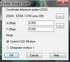
This command opens Google Earth and makes it “fly” to the terrain area that our drawing represents. Also, a specific window can be selected.
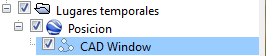
Click OK to open Google Earth and it will move to the location selected, which will appear marked with a polyline referenced as the CAD Window in the list of locations. Deactivating the corresponding box hides the polyline.