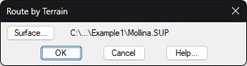
This representation tool is similar to the command found in Maps > Route by Terrain, with the particularity that the field of photovoltaic panels is additionally drawn.
Initially, it will ask us for the OBJ file that represents our photovoltaic plant, this file will be generated with the previous option, Export to 3D Model.
Once the 3D file has been specified, it will ask us for the surface of our project, by default it will take as the surface the one we have established as current.
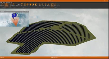
Finally, the Viewer will run showing the surface next to the plates In addition, a new option has been added to this tool which allows us to calculate the shadow cast by the panels according to the time zone.