This list will be very useful to stake out the position of the poles of each tracker.
Initially, when executing this option, it will ask us how we want to calculate the coordinates of the poles, either Calculated or Projected. The difference is that the first gives us the X and Y coordinates in the 3D representation of the tracker axis. On the other hand, the Projected, calculates the coordinate of the pole projected on the plane.
Once the type of calculation for the coordinates of the poles has been selected, we select the trackers to be analyzed, in this type of list, the section can be, either individually, multiple, the trackers that are in a certain area or all the trackers of the project.
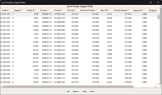
Below is a screenshot of the list, in this case, selecting one of the zones of the project.
An "Export" which allows you to export the calculated coordinates to a point file, this file is designed to carry out the staking out of the poles of the trackers.
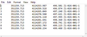
Specifically, the format of the file would be as follows, where the Z coordinate that is exported would be the nominal grade elevation.