MDT is an application that is installed as a plugin on AutoCAD®, BricsCAD®, GstarCAD® or ZWCAD®. It offers a powerful set of tools for easy learning and has a modular structure.
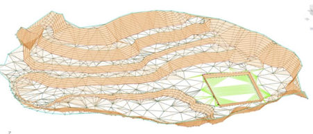
It allows you to model a terrain using points measured by any total station or GNSS receiver, importing files or connecting to web services. It provides options for generation of contour lines, drawing of profiles and cross-sections, calculation of volumes, visualization of terrain in 3D, slope maps, import and export GIS files, etc. It also has functions for working with plots and multiple additional utilities.
TcpMDT Professional
MDT is an application running on AutoCAD®, BricsCAD®, GstarCAD® or ZWCAD®, and has a wide range of easy-to-use tools. Its modular structure allows users to choose the most suitable options for their work.
It includes all features of standard version and provides tools for designing horizontal and vertical alignments, drawing the project templates, area and volume reports, setting-out, virtual tour, measurements and quotations, water, sewerage and rainwater networks, etc. This software is suitable for all kind of surveying projects for roads, urbanizations, quarries... It is easily integrated into OpenBIM workflows, through exchange of IFC and LandXML files.
TcpMDT Surveying
The topography module can be installed over standard or professional MDT, and is very useful for processing total station observations, calculating point coordinates, compensating traverses and networks, etc.
It also allows to perform global and local coordinate transformations. The EPSG database is included with global coverage of reference systems, organized by countries.

 TcpMDT - Help