This command is used to interactively see the road that has just been defined, as well as make any kind of change to the design of the cross section.
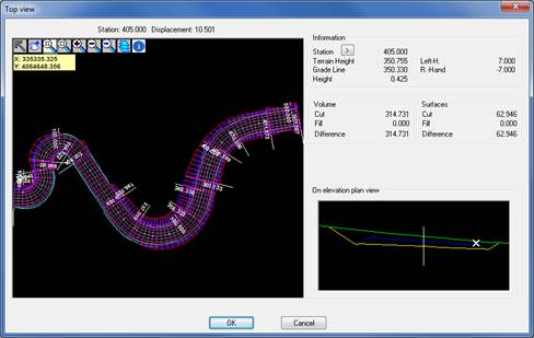
Initially, the program will request the segment we wish to visualize, then the following window will be displayed for visualization.
In the left-hand region of the window the full road is displayed in top view, and basic zoom tools allow for moving along it.
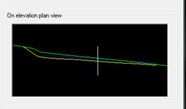
As we pass the mouse over the road, the section of the road in top view appears in the lower right-hand region by way of the cut in the current station.
Also, at all times the program displays the following data in the top right-hand area:
Information:
· Station: Current station.
· >: Clicking this button takes us directly to a particular station.
· Terrain Height: Height of the natural terrain of the vertex selected on-screen.
· Grade line height: Height of the grade line of the vertex selected on-screen.
· Cut/fill: Difference between the height of the terrain and the grade line.
· Left superelevation: superelevation to the left of the current station.
· Right superelevation: superelevation to the right of the current station.
Surfaces: In this section it displays the cut and fill surface of the current station. Additionally, it shows the difference between them.
Volume: Shows the volume of the current station with regard to the next one.
Current Template: This part of the dialog box displays the template we have defined in the station currently selected. The element we are currently positioned appears in black.
There are also buttons with which to define the cross-section or the assignment we have made. These modifications are made in real time.
Definition: Directly accesses the cross-sections definition.
Assignment: Accesses the current assignment of the road.