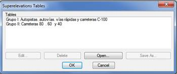
On executing this command, the program will show a window with the existing superelevations tables in accordance with the country selected under settings.
Delete: Removes the superelevations table selected.
Open: Enables us to select a new superelevations table to insert in the list. The Generate Superelevation from Alignment command will activate all the tables we have configured in this section.
Edit: Enables us to edit the superelevations table selected. This window contains a list comprising the Radius, Slope in % and Minimum Clothoid Length columns to be applied to the previous ones. The minimum length is used to calculate the recommended value of the parameter for each radius in accordance with the Road Instructions. See the Personalization Manual for more details.
Optionally, the table may be modified or customized depending on the road design characteristics and the speed assigned to them. The superelevation file is initially requested. Then a dialog box is displayed showing the file’s configuration. Each of the superelevation tables may have different values according to the road design’s speed. The features of the dialog box are described below.
Description: Shows the description of the superelevations table selected.
Speed: Offers the possibility of selecting among the different speeds available in the superelevations table selected.
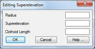
Insert and Edit: Any of the records appearing in the superelevations table may be entered or modified. When any of these buttons is activated, the following dialog box is displayed, where the changes are made.
Delete: Deletes the record marked on the list from the table.
Print: Transfers the information on the superelevation table to the system’s printer or to a file.