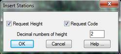
The program initially displays a dialog box where one must specify the data one wishes it to request in the command line.
Additionally, the decimal number that will be used to mark the station in the drawing can be configured.
Once the dialog box has been validated, the program will first request the Name of the station. This may be any combination of a maximum of 8 alphanumeric characters. Spaces and special characters are not accepted. If an invalid name is entered, the program will indicate it with the following message: “ERROR: Invalid name”.
The program will then request the station’s Position on the ground plan, which may be entered using any of AutoCAD’s coordinate entry methods, mainly graphically with the mouse or by typing in its X and Y values separated by a comma. The program then requests Station’s Height if this option has been selected previously in the dialog box. This information is entered numerically.
Lastly, an informative Code made up of a string of up to 14 alphanumeric characters may be assigned. This will be requested should it have been selected in the previous dialog box.
Before drawing the new station, the program checks if it is repeated in the drawing. Two stations are considered to be repeated if they have the same X, Y coordinates or if they have the same name. In either case, the following message is shown: “ERROR: Station already exists”, and the forgoing data will be requested once again.
The station entry process will continue until a null reply is given when station name is requested. In this case, control will revert to AutoCAD.