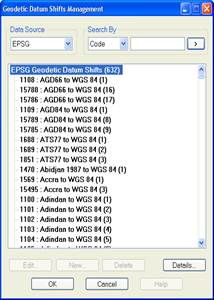
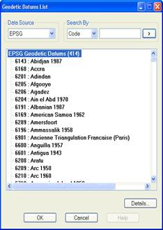
Displays the list of transformations included in the EPSG database that have the WGS 84 or the ETRS 89 as the target reference system.
Each line of the list includes the code and name of the datum shift separated by a colon.
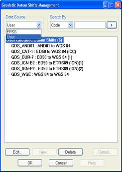
The dropdown list of the Data Source section lets you change the EPSG data query to a user data query and vice versa.
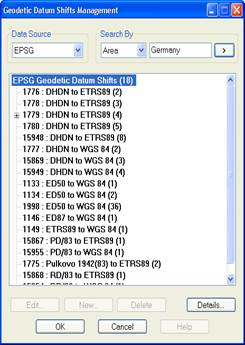
In the Search By section you can filter the query data by Code, Name and Area. The last option is only available for EPSG data. The name of the area (continent, country, etc.) must be specified in English. You have to enter the search string in the box on the right and click the  button. In the case of searching by code, it will only display the result if the code in question exists in the database, whereas in the search by name and area, it will display all the CRS’s whose name or area of use contains the string entered.
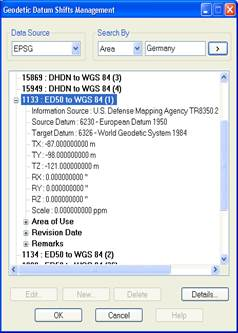
By double-clicking a datum shift on the list, its properties are displayed: Description, Source Datum, Target Datum, Transformation Parameters, Area of Use, Revision Date and Remarks.
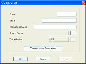
New user datum shifts can be created. The data requested are:
Code: An alphanumeric string of up to 16 characters is allowed.
Name: An alphanumeric string of up to 64 characters is allowed.
Description: Optional field. An alphanumeric string of up to 128 characters is allowed.
Source Datum: Select from the list displayed by clicking the button  .
.
Target Datum: Datum WGS 84 (code EPSG 6326) is established by default.
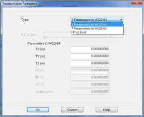
Transformation Parameters: Clicking this button displays the screen where the transformation parameters are entered. 3 types of datum shift are distinguished: 3 Parameters to WGS-84, 7 Parameters to WGS-84 and NTv2 Grid.
The parameters requested for each type of transformation are:
3 Parameters to WGS-84
dX: Displacement X in metres.
dY: Displacement Y in metres.
dZ: Displacement Z in metres.
7 Parameters to WGS-84
dX: Displacement X in metres.
dY: Displacement Y in metres.
dZ: Displacement Z in metres.
dX: Rotation X in arc seconds.
dY: Rotation Y in arc seconds.
dZ: Rotation Z in arc seconds.
dS: Scale in parts per million (ppm)
NTv2 Grid
File containing the data transformation mesh with the format proposed by the Geodetic Survey of Canada, version 2. This file has extension *.GSB and is selected by clicking the button .