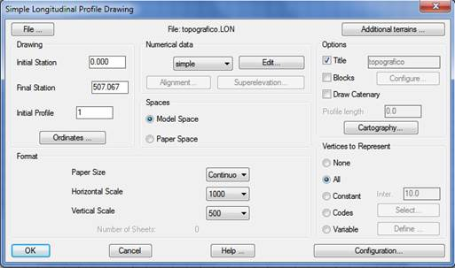
This option allows one to draw on screen a longitudinal profile of the terrain obtained previously by any of the procedures permitted by MDT. It should not be confused with the Profiles > Draw Composite Profile command, which can also draw the grade line, along with the curve and superelevation diagrams.
Once the command is executed, it will request a .LON or .SEG file, and the following dialog box will be displayed. If a segment file is selected, MDT will only extract the information concerning the longitudinal profile.
The window is comprised of the controls described below: