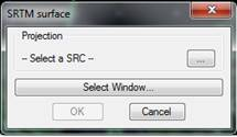
With this command a digital model of any part of the world can be created. Use the data available on the Internet from NASA’s SRTM mission (http://www2.jpl.nasa.gov/srtm/). First, a window is displayed for specifying the system of reference coordinate for the drawing, and a window with the areas to triangulate.
Once the data is introduced, the program downloads the necessary data via the Internet, triangulates it, and last a Draw Surface window is displayed.
The precision of the heights obtained is approximate to the meter, and the separation between each element of the grid is around 90 meters.