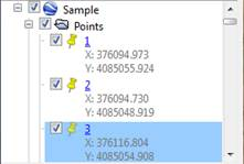
Activating the Points option selects all the points of the drawing by default and the corresponding Select button is used to make a smaller selection. The left panel of Google Earth will display inside a Points folder. Activating or deactivating the folder box controls the visibility of the elements it contains. Unfolding the content, it is possible to activate the visibility individually for each point.
By clicking on the name of the point, a floating window appears with the details, and by double clicking the image is centered on these coordinates.