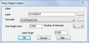
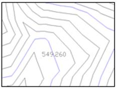
This command enables characteristics heights such as mountain passes, hills or depressions, etc. to be labeled. To do so, the following dialog is displayed:
Once the parameters controlling the label’s appearance have been set, the point to be labeled is clicked with the mouse. The current surface’s height at the point appears in the command line as the height proposed for the label. This height may be substituted by another value.