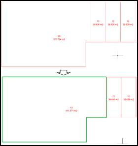
This command allows you to merge two plots into one, if they are adjacent. In the following image you can see how plots 13 and 20 merge into a single plot.
Project Points on Plot Boundaries
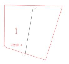
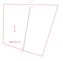
This command places the selected points on the boundaries of a plot, keeping the original points. This is useful for cadastral work where it is necessary to adapt to the official boundaries of the plot.
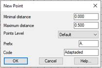
The following dialogue box specifies the available options.
Minimal distance: The distance between the point and the closest side of the plot from which the new points will be created. If 0 is specified, all the points will be created.
Maximum distance: The maximum distance between the point and the closest side of the plot to create the new points. If the distance exceeds the maximum, the point will not be created.
The new points created will have the following properties:
Points level: Indicates the level at which the new points will be created, to separate them from other points, if necessary.
Prefix. If a value is specified, the name to be assigned to each new point will be preceded by the prefix. For example, if "A." is specified as the prefix, a point "A.1" will be created for point "1".
Code. The code assigned to the new points in order to differentiate them from other points.