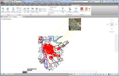
In order to be able to use this command it is necessary to insert an image and have defined at least two Reference lines or Links.
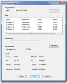
This command will request the selection of an image which will be georeferenced and it will show the following dialogue in which the name of the file of the selected image is revealed which may be changed, designating on the screen the list of all the Reference lines and Links to be found in the drawing which may be activated or deactivated to form part of the transformation calculations and said transformation may be Helmert 2D based on two pairs of points, or Affine, based on three pairs of points. As a result, the MSE, mean square error, will be shown as well as the Max.Res., the maximum residue, X0 and Y0, coordinates of the upper left-hand point of the image, Scale on X and Y, in m/pixel and Rotation in X and Y.
The Apply button allows the viewing of the result of the Georeferencing before endorsing the operation. By pressing OK the Georeferencing is endorsed and the image is inserted in the coordinates resulting from the transformation, the destination directory will be requested for the georeference file which has been created and the Reference lines, Links and Marks will be deleted which have been involved in the transformation. By pressing the Cancel button, the operation cancelled and all the elements are restored.