17.15. Slope Measurements Report |
As with the previous command, in these cases we can generate a list of the length of the slopes or the area of the same. When selecting areas, the list may consist of developed or ground plan areas in the cut and fill slopes of the road of the segment selected.
When this command is executed, the following window is displayed:
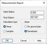
Initial station: Station from which the list is made.
Final station: Station up to which the user wishes to make the list.
Calculation type: We specify whether the measurement we wish to make is in elevation view, meaning a developed area or a area on ground plan.
Areas: Selecting this option enables us to see if the list to be generated features ground plan or raised areas, in other words, a developed area or a ground plan area.
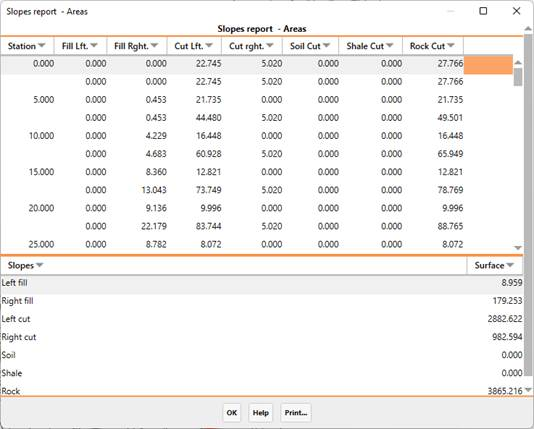
In the case of cut, it also lists the three types of terrains that MDT analyses: Soil, Shale and Rock.
|
|