18.7. Draw Roughness Map |
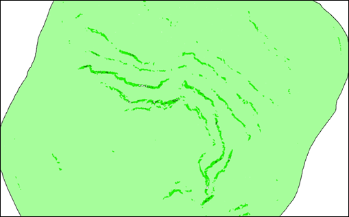
A terrain roughness map is a graphical representation that shows variations in the surface of the terrain, indicating areas where there is greater or lesser "roughness" or irregularity. This roughness refers to variability in the elevation of the earth's surface, such as hills, valleys, depressions, or any other type of irregularity in the terrain that affects the shape of the surface.
First of all, we must establish the surface from which we want to create the roughness map as current and then the following dialog will appear, which we will describe:
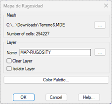
Malla: A partir de la superficie se creará una malla la cual utilizará esta herramienta para realizar el cálculo del mapa de rugosidad.
Capa: Capa en la cual se dibuja la imagen calculada.
Paleta de colores: Selección de la paleta de colores que servirá como base para el cálculo de la imagen.
Finalmente se calculará una imagen de tipo TIFF la cual tendrá el nombre de la superficie seleccionada.
|
|