These files are compatible with the file format for modified terrain cross-section profiles of the TcpMDT (*.LON). These profiles can be obtained by using the command MDT > Longitudinal Profiles > Obtain Profile.
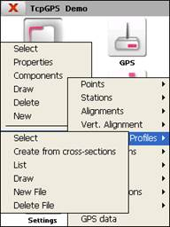
Longitudinal profiles that have previously been generated using the Surveying > Longitudinal Profile option can be viewed and edited using these options.
The options available to manage this kind of files are the following: