
Project challenges
This project focused on 3D scanning and modeling of an interior office building. The main technological challenge was to quickly document and process data from a dense point cloud captured by a portable laser scanner.
Special attention was paid to mapping critical safety elements, such as emergency exits and fire extinguishers, while preparing the data for integration into facility management systems. One of the main requirements was to convert the scan into classified elements and structured CAD drawings suitable for facility planning and documentation.
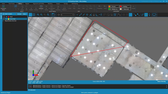
Graphic selection of elements in the point cloud for detailed analysis and classification of the building interior.
Solutions
The building was scanned in a single 10-minute session using the Stonex X120GO scanner. The GO application was used in parallel to capture geotagged images of key objects.
With Tcp PointCloud Editor, the original scan containing 87 million points was filtered and cleaned to retain 23 million relevant points. AI-based automatic classification function was applied to distinguish walls, ceilings, floors, furniture, and windows.
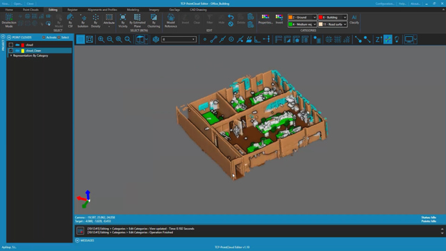
AI-based automatic classification to distinguish architectural elements such as walls, ceilings, floors, furniture, and windows.
Manual classification tools allowed fine-tuning of flat elements such as walls and ceilings. Geographic tags were added and managed within the point cloud, associating images and documentation with real-world locations.
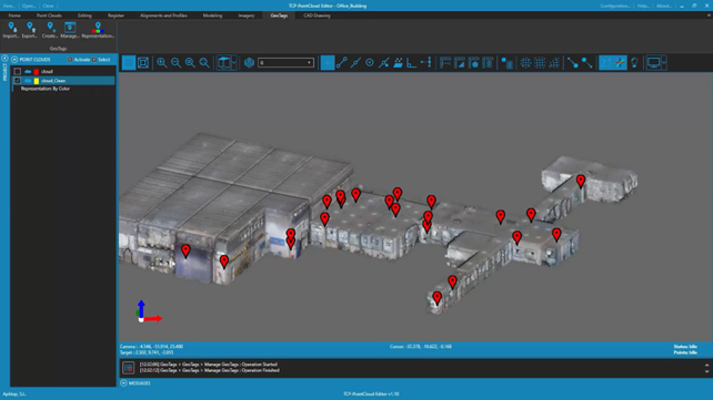
Management of geographic tags to associate images and documentation with specific locations in the point cloud.
Floor plans and 3D models were generated by drawing in the point cloud and using raster-based editing tools. The project concluded with the publication of the complete dataset in TcpShare, allowing collaborators to view and measure the point cloud and its CAD-derived components online.
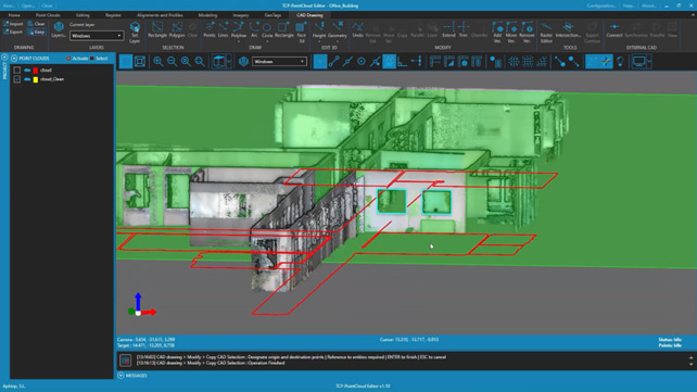
Generation of plans and CAD drawings directly from the point cloud for facility documentation.
Benefits
- The project resulted in significant time savings thanks to the combination of automatic and manual classification tools.
- The team was able to create a detailed and accurate model of the interior, including safety equipment and furniture, which can now be used for facility management purposes.
- The use of geographic tags enriched the dataset with valuable contextual information, such as photos and documentation.
- The ability to generate CAD drawings directly from the point cloud enabled a faster design process.
- Sharing the final model through TcpShare improved team collaboration and allowed external stakeholders to review and validate the results.
- The team confirmed alignment between the captured data and existing CAD plans, which supports quality control and planning tasks.